Area Overview for GL52 7ZE
Photos of GL52 7ZE
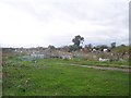
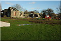
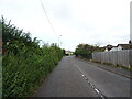
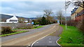
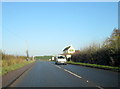
17 photos from this area
Area Information
Key information about the GL52 7ZE including its size, population, and administrative classification.
- Area Type
- Postcode
- Area Size
- 1.5 hectares
- Population
- 2651
- Population Density
- 3947 people/km²
House Prices in GL52 7ZE
24
Properties
£250,687
Average Sold Price
£192,000
Lowest Price
£373,000
Highest Price
Showing 24 properties
| Address | Type | Beds | Baths | Last Sale Price | Last Sale Date | |
|---|---|---|---|---|---|---|
| 31 Moonstone Grove, Bishops Cleeve, Cheltenham, GL52 7ZE | Terraced | 2 | 2 | £260,000 | Dec 2024 | |
| 37 Moonstone Grove, Bishops Cleeve, Cheltenham, GL52 7ZE | Detached | 3 | 2 | £373,000 | Aug 2024 | |
| 3 Moonstone Grove, Bishops Cleeve, Cheltenham, GL52 7ZE | Semi-detached | 3 | 1 | £302,000 | Aug 2023 | |
| 39 Moonstone Grove, Bishops Cleeve, Cheltenham, GL52 7ZE | Retail | 2 | 1 | £257,500 | Oct 2022 | |
| 41 Moonstone Grove, Bishops Cleeve, Cheltenham, GL52 7ZE | house | 3 | 1 | £220,000 | Jul 2020 | |
| 43 Moonstone Grove, Bishops Cleeve, Cheltenham, GL52 7ZE | house | 3 | 2 | £198,000 | Nov 2016 | |
| 33 Moonstone Grove, Bishops Cleeve, Cheltenham, GL52 7ZE | Terraced | 2 | 1 | £192,000 | Jul 2016 | |
| 35 Moonstone Grove, Bishops Cleeve, Cheltenham, GL52 7ZE | house | - | - | £202,995 | Jun 2016 | |
| 11 Moonstone Grove, Bishops Cleeve, Cheltenham, GL52 7ZE | Semi-detached | 3 | 3 | - | - | |
| 17 Moonstone Grove, Bishops Cleeve, Cheltenham, GL52 7ZE | Detached | 3 | 3 | - | - |
Page 1 of 3
Energy Efficiency in GL52 7ZE
Amenities
Schools
| Rank | School | Type | Entry gender | Ages |
|---|
Explore more schools in this area
Go to Schools tabDemographics
Household Size
Two person
most common
Accommodation Type
Houses
most common
Tenure
73
majority
Ethnic Group
White
most common
Religion
N/A
most common
Household Composition
N/A
most common
Age
47
median
Adults (30-64 years)
most common
Household Deprivation
N/A
with no deprivation
NS-SEC
47
in Lower managerial occupations
Explore more demographic insights in this area
Go to Demographics tabPlanning
Planning Constraints
- Flood RiskPremium
- Ramsar Wetland SitesPremium
- Area of Outstanding Natural BeautyPremium
- Protected Nature ReservePremium
- Protected WoodlandPremium