Area Overview for GL52 6YG
Photos of GL52 6YG
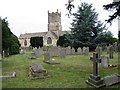
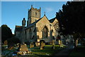


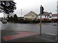
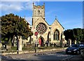
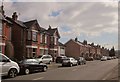
100 photos from this area
Area Information
Key information about the GL52 6YG including its size, population, and administrative classification.
- Area Type
- Postcode
- Area Size
- 2.4 hectares
- Population
- 1370
- Population Density
- 2742 people/km²
House Prices in GL52 6YG
28
Properties
£454,083
Average Sold Price
£246,000
Lowest Price
£880,000
Highest Price
Showing 28 properties
| Address | Type | Beds | Baths | Last Sale Price | Last Sale Date | |
|---|---|---|---|---|---|---|
| 261 London Road, Charlton Kings, Cheltenham, GL52 6YG | Terraced | 3 | 2 | £445,000 | Aug 2025 | |
| 267 London Road, Charlton Kings, Cheltenham, GL52 6YG | Detached | 5 | 3 | £880,000 | Apr 2022 | |
| 253 London Road, Charlton Kings, Cheltenham, GL52 6YG | Detached | 2 | 1 | £625,000 | Apr 2022 | |
| 277 London Road, Charlton Kings, Cheltenham, GL52 6YG | Detached | 4 | 2 | £805,000 | Jun 2021 | |
| 245 London Road, Charlton Kings, Cheltenham, GL52 6YG | Semi-detached | 3 | 2 | £362,500 | Jan 2020 | |
| 263 London Road, Charlton Kings, Cheltenham, GL52 6YG | house | - | - | £255,000 | Mar 2018 | |
| 259 London Road, Charlton Kings, Cheltenham, GL52 6YG | Terraced | 3 | 2 | £377,500 | Nov 2016 | |
| 257 London Road, Charlton Kings, Cheltenham, GL52 6YG | Terraced | 3 | 2 | £260,000 | May 2014 | |
| 249 London Road, Charlton Kings, Cheltenham, GL52 6YG | Detached | 5 | - | £388,000 | May 2012 | |
| 273 London Road, Charlton Kings, Cheltenham, GL52 6YG | Bungalow | 4 | 2 | £445,000 | Nov 2010 |
Page 1 of 3
Energy Efficiency in GL52 6YG
Amenities
Schools
| Rank | School | Type | Entry gender | Ages |
|---|
Explore more schools in this area
Go to Schools tabDemographics
Household Size
Family (3-5 people)
most common
Accommodation Type
Houses
most common
Tenure
88
majority
Ethnic Group
White
most common
Religion
N/A
most common
Household Composition
N/A
most common
Age
47
median
Adults (30-64 years)
most common
Household Deprivation
N/A
with no deprivation
NS-SEC
47
in Lower managerial occupations
Explore more demographic insights in this area
Go to Demographics tabPlanning
Planning Constraints
- Flood RiskPremium
- Ramsar Wetland SitesPremium
- Area of Outstanding Natural BeautyPremium
- Protected Nature ReservePremium
- Protected WoodlandPremium