Area Overview for GL52 6XF
Photos of GL52 6XF
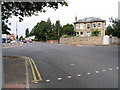


![Cheltenham houses [65] in GL52 6XF](https://images.propbar.co.uk/images/geograph/65/37/6537368_120.jpg)
Area Information
Living in GL52 6XF offers a quiet, residential experience with a small, tightly knit community. The area’s population of 1,713 suggests a compact cluster of homes, likely centred around local amenities and transport links. Daily life here is shaped by proximity to Cheltenham Spa Railway Station and nearby metro points like Cheltenham Racecourse and Gotherington, offering easy access to regional hubs. The area’s low crime risk—rated 90/100—means residents can enjoy a sense of security, while the absence of flood risk or protected natural sites ensures no environmental constraints on development or living. With a median age of 47 and a majority of residents aged 30–64, the community is stable and likely family-oriented. Retail options such as Co-op Charlton and Asda Sixways provide essential shopping, while three nearby airports suggest strong connectivity for travel. GL52 6XF is ideal for those seeking a balanced mix of convenience, safety, and a low-maintenance lifestyle without the pressures of urban density.
- Area Type
- Postcode
- Area Size
- Not available
- Population
- 1713
- Population Density
- 4538 people/km²
The property market in GL52 6XF is characterised by a high rate of home ownership—76%—indicating that most properties are owner-occupied rather than rented out. This suggests a stable, long-term resident base with fewer short-term rental properties. The accommodation type is predominantly houses, which may imply a focus on family homes or larger dwellings. Given the area’s small size and low population density, the housing stock is likely limited in scale, with limited scope for new developments. For buyers, this means a market where properties are likely to be in good condition, with fewer speculative investments. The absence of rental properties also means competition for available homes may be lower, but buyers should consider the limited inventory and the potential for slower price appreciation compared to more dynamic markets. The focus on houses also means that flats or smaller units are unlikely to be prominent in the area.
House Prices in GL52 6XF
No properties found in this postcode.
Energy Efficiency in GL52 6XF
Residents of GL52 6XF have access to a range of local amenities, including five retail outlets such as Co-op Charlton and Asda Sixways, which provide essential shopping and services. The proximity to Cheltenham Spa Railway Station and metro points like Cheltenham Racecourse and Gotherington ensures convenient travel for work or leisure. Three nearby airports, all Gloucestershire Airport, offer easy access to regional and national destinations. While the area itself is small, the surrounding towns provide additional options for dining, entertainment, and cultural activities. The presence of multiple retail stores suggests a focus on practicality over luxury, catering to daily needs rather than niche markets. The limited local amenities mean residents may need to venture further for specialist services, but the area’s transport links mitigate this by providing efficient access to larger centres. The combination of retail, transport, and nearby airports creates a lifestyle that balances convenience with the need for broader connectivity.
Amenities
Schools
| Rank | School | Type | Entry gender | Ages |
|---|
Explore more schools in this area
Go to Schools tabDemographics
The community in GL52 6XF is predominantly composed of adults aged 30–64, with a median age of 47. This suggests a mature, established population, likely with long-term ties to the area. Home ownership is high, at 76%, indicating a strong presence of owner-occupied properties. The accommodation type is primarily houses, which aligns with the area’s residential character and may reflect a preference for larger, more permanent homes. The predominant ethnic group is White, which is consistent with broader demographic trends in the region. While specific data on deprivation is not provided, the high home ownership rate and low crime risk suggest a relatively stable economic environment. The absence of significant diversity data means the area’s cultural makeup remains largely unexplored in this context, but the demographic profile points to a cohesive, long-standing community with limited turnover.
Household Size
Accommodation Type
Tenure
Ethnic Group
Religion
Household Composition
Age
Household Deprivation
NS-SEC
Explore more demographic insights in this area
Go to Demographics tabPlanning
Planning Constraints
- Flood RiskPremium
- Ramsar Wetland SitesPremium
- Area of Outstanding Natural BeautyPremium
- Protected Nature ReservePremium
- Protected WoodlandPremium