Area Overview for GL52 6PY
Photos of GL52 6PY
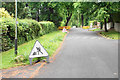
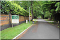
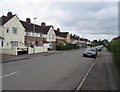
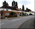
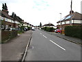
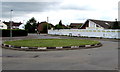
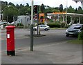
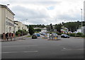
75 photos from this area
Area Information
Key information about the GL52 6PY including its size, population, and administrative classification.
- Area Type
- Postcode
- Area Size
- 9871 m²
- Population
- 1463
- Population Density
- 1998 people/km²
House Prices in GL52 6PY
12
Properties
£428,750
Average Sold Price
£108,500
Lowest Price
£720,000
Highest Price
Showing 12 properties
| Address | Type | Beds | Baths | Last Sale Price | Last Sale Date | |
|---|---|---|---|---|---|---|
| 27 Harp Hill, Charlton Kings, Cheltenham, GL52 6PY | Semi-detached | 4 | 1 | £720,000 | Nov 2025 | |
| Newborough, 15 Harp Hill, Charlton Kings, Cheltenham, GL52 6PY | Semi-detached | 3 | 1 | £474,000 | Oct 2024 | |
| Thaylin, 11 Harp Hill, Charlton Kings, Cheltenham, GL52 6PY | Semi-detached | 3 | 1 | £341,000 | Nov 2018 | |
| Rosemary, 9 Harp Hill, Charlton Kings, Cheltenham, GL52 6PY | Semi-detached | 3 | - | £329,000 | Mar 2016 | |
| 33 Harp Hill, Charlton Kings, Cheltenham, GL52 6PY | Detached | 4 | 2 | £600,000 | Dec 2014 | |
| 29 Harp Hill, Charlton Kings, Cheltenham, GL52 6PY | Semi-detached | - | - | £108,500 | May 1996 | |
| Oakridge, 7 Harp Hill, Charlton Kings, Cheltenham, GL52 6PY | Semi-detached | 3 | - | - | - | |
| Lonay, 21 Harp Hill, Charlton Kings, Cheltenham, GL52 6PY | house | - | - | - | - | |
| Highclere, 19 Harp Hill, Charlton Kings, Cheltenham, GL52 6PY | Semi-detached | - | - | - | - | |
| 31 Harp Hill, Charlton Kings, Cheltenham, GL52 6PY | house | - | - | - | - |
Page 1 of 2
Energy Efficiency in GL52 6PY
Amenities
Schools
| Rank | School | Type | Entry gender | Ages |
|---|
Explore more schools in this area
Go to Schools tabDemographics
Household Size
Two person
most common
Accommodation Type
Houses
most common
Tenure
85
majority
Ethnic Group
White
most common
Religion
N/A
most common
Household Composition
N/A
most common
Age
47
median
Adults (30-64 years)
most common
Household Deprivation
N/A
with no deprivation
NS-SEC
55
in Lower managerial occupations
Explore more demographic insights in this area
Go to Demographics tabPlanning
Planning Constraints
- Flood RiskPremium
- Ramsar Wetland SitesPremium
- Area of Outstanding Natural BeautyPremium
- Protected Nature ReservePremium
- Protected WoodlandPremium