Area Overview for GL52 6LQ
Photos of GL52 6LQ
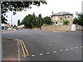
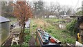
![Cheltenham houses [65] in GL52 6LQ](https://images.propbar.co.uk/images/geograph/65/37/6537368_120.jpg)
100 photos from this area
Area Information
Key information about the GL52 6LQ including its size, population, and administrative classification.
- Area Type
- Postcode
- Area Size
- 458 m²
- Population
- 1475
- Population Density
- 288 people/km²
House Prices in GL52 6LQ
5
Properties
£283,125
Average Sold Price
£114,500
Lowest Price
£625,000
Highest Price
Showing 5 properties
| Address | Type | Beds | Baths | Last Sale Price | Last Sale Date | |
|---|---|---|---|---|---|---|
| 2, Ashley Mews, Ryeworth Road, Charlton Kings, Cheltenham, GL52 6LQ | Flat | - | - | £215,000 | Oct 2020 | |
| Ashley Lodge, Ryeworth Road, Charlton Kings, Cheltenham, GL52 6LQ | house | 3 | - | £625,000 | Oct 2018 | |
| 5, Ashley Mews, Ryeworth Road, Charlton Kings, Cheltenham, GL52 6LQ | Flat | - | - | £178,000 | Dec 2017 | |
| 1, Ashley Mews, Ryeworth Road, Charlton Kings, Cheltenham, GL52 6LQ | Flat | 2 | - | £114,500 | Nov 2001 | |
| Ashley Mews, Ryeworth Road, Charlton Kings, Cheltenham, GL52 6LQ | Semi-detached | - | - | - | - |
Energy Efficiency in GL52 6LQ
Amenities
Schools
| Rank | School | Type | Entry gender | Ages |
|---|
Explore more schools in this area
Go to Schools tabDemographics
Household Size
Family (3-5 people)
most common
Accommodation Type
Houses
most common
Tenure
89
majority
Ethnic Group
White
most common
Religion
N/A
most common
Household Composition
N/A
most common
Age
47
median
Adults (30-64 years)
most common
Household Deprivation
N/A
with no deprivation
NS-SEC
53
in Lower managerial occupations
Explore more demographic insights in this area
Go to Demographics tabPlanning
Planning Constraints
- Flood RiskPremium
- Ramsar Wetland SitesPremium
- Area of Outstanding Natural BeautyPremium
- Protected Nature ReservePremium
- Protected WoodlandPremium