Area Overview for GL52 6DZ
Photos of GL52 6DZ
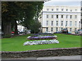


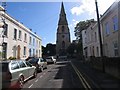


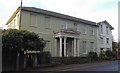
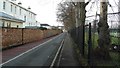

104 photos from this area
Area Information
Key information about the GL52 6DZ including its size, population, and administrative classification.
- Area Type
- Postcode
- Area Size
- 1.2 hectares
- Population
- 1656
- Population Density
- 5537 people/km²
House Prices in GL52 6DZ
38
Properties
£996,786
Average Sold Price
£570,502
Lowest Price
£1,500,000
Highest Price
Showing 38 properties
| Address | Type | Beds | Baths | Last Sale Price | Last Sale Date | |
|---|---|---|---|---|---|---|
| 4 Sydenham Villas Road, Cheltenham, GL52 6DZ | Semi-detached | 2 | 2 | £1,300,000 | Jan 2022 | |
| 20 Sydenham Villas Road, Cheltenham, GL52 6DZ | house | - | - | £875,000 | Sep 2021 | |
| 6 Sydenham Villas Road, Cheltenham, GL52 6DZ | Semi-detached | 6 | 4 | £1,125,000 | Dec 2020 | |
| 36 Sydenham Villas Road, Cheltenham, GL52 6DZ | house | - | - | £570,502 | Feb 2011 | |
| 30 Sydenham Villas Road, Cheltenham, GL52 6DZ | house | 7 | - | £1,500,000 | Jan 2011 | |
| 32 Sydenham Villas Road, Cheltenham, GL52 6DZ | Semi-detached | - | - | £622,000 | Jul 2009 | |
| 40 Sydenham Villas Road, Cheltenham, GL52 6DZ | Semi-detached | - | - | £985,000 | Apr 2007 | |
| Flat 4, 8 Sydenham Villas Road, Cheltenham, GL52 6DZ | Flat | 1 | 1 | - | - | |
| 42 Sydenham Villas Road, Cheltenham, GL52 6DZ | Semi-detached | 6 | 3 | - | - | |
| Flat 1, 14 Sydenham Villas Road, Cheltenham, GL52 6DZ | Flat | - | - | - | - |
Page 1 of 4
Energy Efficiency in GL52 6DZ
Amenities
Schools
| Rank | School | Type | Entry gender | Ages |
|---|
Explore more schools in this area
Go to Schools tabDemographics
Household Size
Two person
most common
Accommodation Type
Houses
most common
Tenure
71
majority
Ethnic Group
White
most common
Religion
N/A
most common
Household Composition
N/A
most common
Age
47
median
Adults (30-64 years)
most common
Household Deprivation
N/A
with no deprivation
NS-SEC
54
in Lower managerial occupations
Explore more demographic insights in this area
Go to Demographics tabPlanning
Planning Constraints
- Flood RiskPremium
- Ramsar Wetland SitesPremium
- Area of Outstanding Natural BeautyPremium
- Protected Nature ReservePremium
- Protected WoodlandPremium