Area Overview for GL52 3YZ
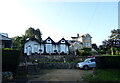
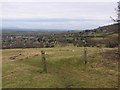
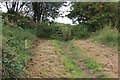
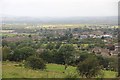
Photos of GL52 3YZ
Area Information
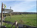
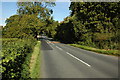
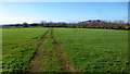
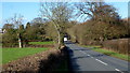
Living in GL52 3YZ offers a quiet, residential experience within a small cluster of homes. With a population of 2,106 and a density of 88 people per square kilometre, the area feels uncluttered, balancing privacy with proximity to essential services. The community is defined by its stability, with a median age of 47 and a strong presence of adults aged 30–64. This suggests a mature, established population, likely drawn to the area’s low crime rates and lack of environmental constraints. Daily life here is shaped by local amenities such as Co-op Bishops, Asda Kingswood, and Tesco Bishops, which cater to everyday needs. The area’s location near Cheltenham Racecourse and Gotherington adds a touch of regional charm, while rail access to Cheltenham Spa and Ashchurch for Tewkesbury stations ensures connectivity to nearby towns. GL52 3YZ is ideal for those seeking a peaceful, low-maintenance lifestyle with access to both rural tranquillity and practical urban amenities.
- Area Type
- Postcode
- Area Size
- Not available
- Population
- 2106
- Population Density
- 88 people/km²
The property market in GL52 3YZ is dominated by owner-occupied homes, with 89% of residents living in properties they own. This high home ownership rate suggests a stable, long-term community with limited rental activity. The accommodation type is primarily houses, which are more common than flats or apartments in this area. This housing stock aligns with the demographic profile of the area—middle-aged adults seeking established, private residences. The small size of the postcode area means the housing stock is limited, potentially making the local market competitive for buyers. However, the absence of planning constraints such as protected woodlands or Areas of Outstanding Natural Beauty may simplify development or renovation options. For buyers, this suggests a focus on individual properties rather than larger estates, with potential for investment in homes that cater to the needs of a mature, settled population.
House Prices in GL52 3YZ
No properties found in this postcode.
Energy Efficiency in GL52 3YZ
The lifestyle in GL52 3YZ is supported by a range of accessible amenities. Local shops such as Co-op Bishops, Asda Kingswood, and Tesco Bishops provide convenience for daily errands, while nearby leisure spots like Cheltenham Racecourse and Gotherington offer recreational opportunities. The area’s rail links to Cheltenham Spa and Ashchurch for Tewkesbury stations connect residents to cultural and commercial centres. For travel, two Gloucestershire Airport locations are within practical reach, enabling regional and national travel. The mix of retail, transport, and leisure options ensures a balanced daily life, blending local convenience with broader connectivity. Whether shopping, attending events, or commuting, residents have the tools to maintain both independence and engagement with the wider world.
Amenities
Schools
| Rank | School | Type | Entry gender | Ages |
|---|
Explore more schools in this area
Go to Schools tabDemographics
The community in GL52 3YZ is predominantly composed of adults aged 30–64, with a median age of 47. This suggests a mature, settled population, likely with established careers and families. Home ownership is exceptionally high at 89%, indicating a strong preference for long-term residency over rental living. The area is characterised by houses rather than flats, reflecting a traditional, family-oriented housing stock. The predominant ethnic group is White, though specific data on diversity is not provided. The low population density of 88 people per square kilometre implies a spread-out, less congested environment. With no mention of deprivation or socioeconomic challenges in the data, the area appears to support a stable quality of life, where residents can expect reliable infrastructure and a cohesive, community-focused atmosphere.
Household Size
Accommodation Type
Tenure
Ethnic Group
Religion
Household Composition
Age
Household Deprivation
NS-SEC
Explore more demographic insights in this area
Go to Demographics tabPlanning
Planning Constraints
- Flood RiskPremium
- Ramsar Wetland SitesPremium
- Area of Outstanding Natural BeautyPremium
- Protected Nature ReservePremium
- Protected WoodlandPremium