Area Overview for GL51 9HH
Photos of GL51 9HH
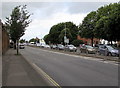
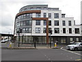
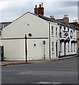
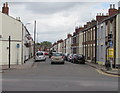
86 photos from this area
Area Information
Key information about the GL51 9HH including its size, population, and administrative classification.
- Area Type
- Postcode
- Area Size
- 6534 m²
- Population
- 1666
- Population Density
- 7532 people/km²
House Prices in GL51 9HH
40
Properties
£155,625
Average Sold Price
£33,750
Lowest Price
£267,000
Highest Price
Showing 40 properties
| Address | Type | Beds | Baths | Last Sale Price | Last Sale Date | |
|---|---|---|---|---|---|---|
| 16 Charles Street, Cheltenham, GL51 9HH | Terraced | 2 | 1 | £231,000 | Mar 2025 | |
| 14 Charles Street, Cheltenham, GL51 9HH | Terraced | 3 | 1 | £267,000 | Oct 2024 | |
| 37 Charles Street, Cheltenham, GL51 9HH | Terraced | 2 | 1 | £225,000 | Aug 2024 | |
| 11 Charles Street, Cheltenham, GL51 9HH | Terraced | 2 | 1 | £260,000 | Jul 2024 | |
| 26 Charles Street, Cheltenham, GL51 9HH | Terraced | 2 | 2 | £250,000 | Sep 2023 | |
| 29 Charles Street, Cheltenham, GL51 9HH | Terraced | - | - | £185,000 | Dec 2021 | |
| 15 Charles Street, Cheltenham, GL51 9HH | Terraced | 2 | 1 | £200,000 | Sep 2021 | |
| 33 Charles Street, Cheltenham, GL51 9HH | Terraced | 2 | 1 | £200,000 | Sep 2020 | |
| 34 Charles Street, Cheltenham, GL51 9HH | house | 3 | 2 | £200,000 | Feb 2020 | |
| 6 Charles Street, Cheltenham, GL51 9HH | Terraced | 2 | 1 | £198,000 | Dec 2018 |
Page 1 of 4
Energy Efficiency in GL51 9HH
Amenities
Schools
| Rank | School | Type | Entry gender | Ages |
|---|
Explore more schools in this area
Go to Schools tabDemographics
Household Size
One person
most common
Accommodation Type
Houses
most common
Tenure
40
majority
Ethnic Group
White
most common
Religion
N/A
most common
Household Composition
N/A
most common
Age
22
median
Young Adults (15-29 years)
most common
Household Deprivation
N/A
with no deprivation
NS-SEC
20
in Lower managerial occupations
Explore more demographic insights in this area
Go to Demographics tabPlanning
Planning Constraints
- Flood RiskPremium
- Ramsar Wetland SitesPremium
- Area of Outstanding Natural BeautyPremium
- Protected Nature ReservePremium
- Protected WoodlandPremium