Area Overview for GL51 9ET
Photos of GL51 9ET

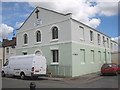
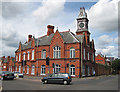
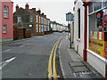
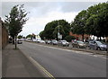
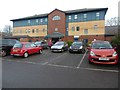
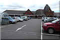
86 photos from this area
Area Information
Key information about the GL51 9ET including its size, population, and administrative classification.
- Area Type
- Postcode
- Area Size
- 3367 m²
- Population
- 1253
- Population Density
- 7371 people/km²
House Prices in GL51 9ET
23
Properties
£158,393
Average Sold Price
£40,000
Lowest Price
£300,000
Highest Price
Showing 23 properties
| Address | Type | Beds | Baths | Last Sale Price | Last Sale Date | |
|---|---|---|---|---|---|---|
| 32 Swindon Street, Cheltenham, GL51 9ET | Terraced | 2 | 1 | £285,000 | Sep 2024 | |
| 47 Swindon Street, Cheltenham, GL51 9ET | Terraced | 2 | 1 | £205,000 | Sep 2022 | |
| 31 Swindon Street, Cheltenham, GL51 9ET | Terraced | 5 | 1 | £300,000 | Aug 2022 | |
| 39 Swindon Street, Cheltenham, GL51 9ET | house | - | - | £200,000 | Dec 2016 | |
| 2, Rose Villas, Swindon Street, Cheltenham, GL51 9ET | Terraced | 4 | 1 | £230,000 | Aug 2016 | |
| 43 Swindon Street, Cheltenham, GL51 9ET | Terraced | 3 | 1 | £175,000 | May 2013 | |
| 42 Swindon Street, Cheltenham, GL51 9ET | Terraced | 2 | 2 | £148,000 | Jul 2011 | |
| 28 Swindon Street, Cheltenham, GL51 9ET | Terraced | 2 | 1 | £142,000 | Jul 2008 | |
| 30 Swindon Street, Cheltenham, GL51 9ET | house | - | - | £140,000 | Apr 2007 | |
| 37 Swindon Street, Cheltenham, GL51 9ET | house | 5 | - | £157,000 | May 2006 |
Page 1 of 3
Energy Efficiency in GL51 9ET
Amenities
Schools
| Rank | School | Type | Entry gender | Ages |
|---|
Explore more schools in this area
Go to Schools tabDemographics
Household Size
One person
most common
Accommodation Type
Houses
most common
Tenure
27
majority
Ethnic Group
White
most common
Religion
N/A
most common
Household Composition
N/A
most common
Age
47
median
Adults (30-64 years)
most common
Household Deprivation
N/A
with no deprivation
NS-SEC
18
in Lower managerial occupations
Explore more demographic insights in this area
Go to Demographics tabPlanning
Planning Constraints
- Flood RiskPremium
- Ramsar Wetland SitesPremium
- Area of Outstanding Natural BeautyPremium
- Protected Nature ReservePremium
- Protected WoodlandPremium