Area Overview for GL51 8PG
Photos of GL51 8PG
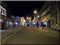
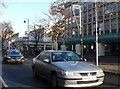
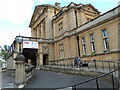
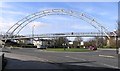
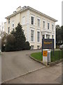

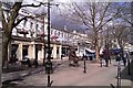
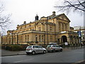
100 photos from this area
Area Information
Key information about the GL51 8PG including its size, population, and administrative classification.
- Area Type
- Postcode
- Area Size
- 7157 m²
- Population
- 1317
- Population Density
- 4046 people/km²
House Prices in GL51 8PG
56
Properties
£182,736
Average Sold Price
£32,500
Lowest Price
£370,000
Highest Price
Showing 56 properties
| Address | Type | Beds | Baths | Last Sale Price | Last Sale Date | |
|---|---|---|---|---|---|---|
| 22 Bloomsbury Street, Cheltenham, GL51 8PG | house | 2 | 1 | £196,500 | Jun 2025 | |
| 26 Bloomsbury Street, Cheltenham, GL51 8PG | Terraced | 2 | 2 | £257,500 | May 2025 | |
| 46 Bloomsbury Street, Cheltenham, GL51 8PG | Terraced | 2 | 1 | £228,000 | Feb 2025 | |
| 33 Bloomsbury Street, Cheltenham, GL51 8PG | Terraced | 2 | 2 | £267,500 | Nov 2024 | |
| 1 Bloomsbury Street, Cheltenham, GL51 8PG | Terraced | 1 | 1 | £220,000 | Aug 2024 | |
| 46A Bloomsbury Street, Cheltenham, GL51 8PG | Terraced | 2 | 1 | £225,000 | Aug 2024 | |
| 3 Bloomsbury Street, Cheltenham, GL51 8PG | Terraced | 3 | 2 | £370,000 | May 2023 | |
| 12 Bloomsbury Street, Cheltenham, GL51 8PG | Terraced | 3 | 2 | £300,000 | Apr 2023 | |
| 15 Bloomsbury Street, Cheltenham, GL51 8PG | Terraced | 2 | 1 | £245,000 | Nov 2022 | |
| 31 Bloomsbury Street, Cheltenham, GL51 8PG | Terraced | 2 | 2 | £290,000 | Aug 2022 |
Page 1 of 6
Energy Efficiency in GL51 8PG
Amenities
Schools
| Rank | School | Type | Entry gender | Ages |
|---|
Explore more schools in this area
Go to Schools tabDemographics
Household Size
One person
most common
Accommodation Type
Houses
most common
Tenure
47
majority
Ethnic Group
White
most common
Religion
N/A
most common
Household Composition
N/A
most common
Age
47
median
Adults (30-64 years)
most common
Household Deprivation
N/A
with no deprivation
NS-SEC
39
in Lower managerial occupations
Explore more demographic insights in this area
Go to Demographics tabPlanning
Planning Constraints
- Flood RiskPremium
- Ramsar Wetland SitesPremium
- Area of Outstanding Natural BeautyPremium
- Protected Nature ReservePremium
- Protected WoodlandPremium