Area Overview for GL51 4XJ
Photos of GL51 4XJ
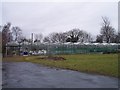
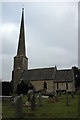
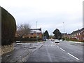
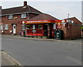
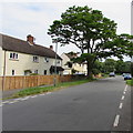
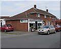
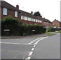
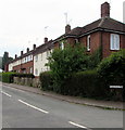
79 photos from this area
Area Information
Key information about the GL51 4XJ including its size, population, and administrative classification.
- Area Type
- Postcode
- Area Size
- 9.4 hectares
- Population
- 2586
- Population Density
- 301 people/km²
House Prices in GL51 4XJ
44
Properties
£352,909
Average Sold Price
£79,995
Lowest Price
£1,190,000
Highest Price
Showing 44 properties
| Address | Type | Beds | Baths | Last Sale Price | Last Sale Date | |
|---|---|---|---|---|---|---|
| Brigarde House, Main Road, Shurdington, Cheltenham, GL51 4XJ | Detached | 4 | 3 | £570,000 | Jul 2025 | |
| Yew Tree Cottage, Main Road, Shurdington, Cheltenham, GL51 4XJ | Detached | 3 | 1 | £295,000 | Mar 2025 | |
| Shurdington Lodge, Main Road, Shurdington, Cheltenham, GL51 4XJ | Detached | 3 | 2 | £545,000 | Jan 2025 | |
| Shalands, Main Road, Shurdington, Cheltenham, GL51 4XJ | Semi-detached | 3 | 2 | £308,000 | Dec 2024 | |
| Shurdington House Stables, Main Road, Shurdington, Cheltenham, GL51 4XJ | house | - | - | £1,190,000 | Dec 2022 | |
| Tamar, Main Road, Shurdington, Cheltenham, GL51 4XJ | house | - | - | £230,000 | Aug 2021 | |
| Hillside View, Main Road, Shurdington, Cheltenham, GL51 4XJ | Semi-detached | 3 | 1 | £370,000 | Mar 2021 | |
| Woodville, Main Road, Shurdington, Cheltenham, GL51 4XJ | Detached | 4 | 3 | £560,000 | Oct 2019 | |
| Woodbine Cottage, Main Road, Shurdington, Cheltenham, GL51 4XJ | Detached | 1 | 1 | £575,000 | Jun 2019 | |
| Ensley Cottage, Main Road, Shurdington, Cheltenham, GL51 4XJ | house | - | - | £312,500 | Jun 2019 |
Page 1 of 5
Energy Efficiency in GL51 4XJ
Amenities
Schools
| Rank | School | Type | Entry gender | Ages |
|---|
Explore more schools in this area
Go to Schools tabDemographics
Household Size
Family (3-5 people)
most common
Accommodation Type
Houses
most common
Tenure
70
majority
Ethnic Group
White
most common
Religion
N/A
most common
Household Composition
N/A
most common
Age
47
median
Adults (30-64 years)
most common
Household Deprivation
N/A
with no deprivation
NS-SEC
41
in Lower managerial occupations
Explore more demographic insights in this area
Go to Demographics tabPlanning
Planning Constraints
- Flood RiskPremium
- Ramsar Wetland SitesPremium
- Area of Outstanding Natural BeautyPremium
- Protected Nature ReservePremium
- Protected WoodlandPremium