Area Overview for GL51 4XB
Photos of GL51 4XB


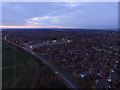
13 photos from this area
Area Information
Key information about the GL51 4XB including its size, population, and administrative classification.
- Area Type
- Postcode
- Area Size
- 12.9 hectares
- Population
- 2586
- Population Density
- 301 people/km²
House Prices in GL51 4XB
11
Properties
£505,833
Average Sold Price
£140,000
Lowest Price
£830,000
Highest Price
Showing 11 properties
| Address | Type | Beds | Baths | Last Sale Price | Last Sale Date | |
|---|---|---|---|---|---|---|
| St Francis, Chargrove Lane, Shurdington, Cheltenham, GL51 4XB | Detached | 3 | 3 | £690,000 | Feb 2024 | |
| Larkspur House, Chargrove Lane, Shurdington, Cheltenham, GL51 4XB | Detached | 4 | 3 | £830,000 | Jan 2023 | |
| The Gables, Chargrove Lane, Shurdington, Cheltenham, GL51 4XB | house | - | - | £655,000 | Sep 2017 | |
| Ponderosa, Chargrove Lane, Shurdington, Cheltenham, GL51 4XB | Bungalow | 4 | - | £550,000 | May 2011 | |
| Pages, Chargrove Lane, Shurdington, Cheltenham, GL51 4XB | Detached | - | - | £140,000 | Sep 1996 | |
| Penlee, Chargrove Lane, Shurdington, Cheltenham, GL51 4XB | Detached | - | - | £170,000 | Jun 1996 | |
| Romany, Chargrove Lane, Shurdington, Cheltenham, GL51 4XB | Bungalow | 3 | 2 | - | - | |
| Ormonde, Chargrove Lane, Shurdington, Cheltenham, GL51 4XB | house | 6 | - | - | - | |
| Oak Farm, Chargrove Lane, Shurdington, Cheltenham, GL51 4XB | Detached | - | - | - | - | |
| The Rowans, Chargrove Lane, Shurdington, Cheltenham, GL51 4XB | Detached | - | - | - | - |
Page 1 of 2
Energy Efficiency in GL51 4XB
Amenities
Schools
| Rank | School | Type | Entry gender | Ages |
|---|
Explore more schools in this area
Go to Schools tabDemographics
Household Size
Family (3-5 people)
most common
Accommodation Type
Houses
most common
Tenure
70
majority
Ethnic Group
White
most common
Religion
N/A
most common
Household Composition
N/A
most common
Age
47
median
Adults (30-64 years)
most common
Household Deprivation
N/A
with no deprivation
NS-SEC
41
in Lower managerial occupations
Explore more demographic insights in this area
Go to Demographics tabPlanning
Planning Constraints
- Flood RiskPremium
- Ramsar Wetland SitesPremium
- Area of Outstanding Natural BeautyPremium
- Protected Nature ReservePremium
- Protected WoodlandPremium