Area Overview for GL51 4TZ
Photos of GL51 4TZ
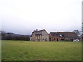
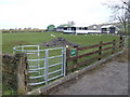
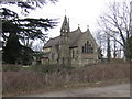
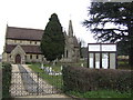
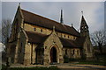


27 photos from this area
Area Information
Key information about the GL51 4TZ including its size, population, and administrative classification.
- Area Type
- Postcode
- Area Size
- 63.7 hectares
- Population
- 1105
- Population Density
- 87 people/km²
House Prices in GL51 4TZ
22
Properties
£575,462
Average Sold Price
£142,000
Lowest Price
£1,450,000
Highest Price
Showing 22 properties
| Address | Type | Beds | Baths | Last Sale Price | Last Sale Date | |
|---|---|---|---|---|---|---|
| The Cottage, Dark Lane, Bentham, Cheltenham, GL51 4TZ | Detached | 4 | 2 | £1,424,000 | Mar 2025 | |
| Bridge House, Bentham Lane, Bentham, Cheltenham, GL51 4TZ | Detached | 5 | - | £1,450,000 | Jan 2023 | |
| Oak Farm, Bentham Lane, Bentham, Cheltenham, GL51 4TZ | house | - | - | £250,000 | Aug 2021 | |
| Jones House, Bentham Lane, Bentham, Cheltenham, GL51 4TZ | house | 4 | 1 | £350,000 | May 2018 | |
| The Firs, Bentham Lane, Bentham, Cheltenham, GL51 4TZ | Detached | 7 | 5 | £1,250,000 | Jul 2016 | |
| Hill View, Bentham Lane, Bentham, Cheltenham, GL51 4TZ | Detached | 4 | 3 | £530,000 | Jun 2010 | |
| The Old Hay Barn, Bentham Lane, Bentham, Cheltenham, GL51 4TZ | Detached | 6 | 3 | £220,000 | Jan 2010 | |
| Barbara Cottage, Dog Lane, Witcombe, Cheltenham, GL51 4TZ | Detached | - | - | £373,000 | Jun 2005 | |
| The Elms, Bentham Lane, Bentham, Cheltenham, GL51 4TZ | house | 4 | - | £675,000 | Nov 2003 | |
| Bentham Old Hall, Bentham Lane, Bentham, Cheltenham, GL51 4TZ | Detached | - | - | £397,000 | May 2002 |
Page 1 of 3
Energy Efficiency in GL51 4TZ
Amenities
Schools
| Rank | School | Type | Entry gender | Ages |
|---|
Explore more schools in this area
Go to Schools tabDemographics
Household Size
Two person
most common
Accommodation Type
Houses
most common
Tenure
78
majority
Ethnic Group
White
most common
Religion
N/A
most common
Household Composition
N/A
most common
Age
47
median
Adults (30-64 years)
most common
Household Deprivation
N/A
with no deprivation
NS-SEC
41
in Lower managerial occupations
Explore more demographic insights in this area
Go to Demographics tabPlanning
Planning Constraints
- Flood RiskPremium
- Ramsar Wetland SitesPremium
- Area of Outstanding Natural BeautyPremium
- Protected Nature ReservePremium
- Protected WoodlandPremium