Area Overview for GL51 3UU
Photos of GL51 3UU

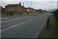


20 photos from this area
Area Information
Key information about the GL51 3UU including its size, population, and administrative classification.
- Area Type
- Postcode
- Area Size
- 9412 m²
- Population
- 1296
- Population Density
- 5369 people/km²
House Prices in GL51 3UU
29
Properties
£181,737
Average Sold Price
£54,000
Lowest Price
£379,950
Highest Price
Showing 29 properties
| Address | Type | Beds | Baths | Last Sale Price | Last Sale Date | |
|---|---|---|---|---|---|---|
| 17 Rothermere Close, Up Hatherley, Cheltenham, GL51 3UU | Flat | - | - | £130,000 | Sep 2023 | |
| 20 Rothermere Close, Up Hatherley, Cheltenham, GL51 3UU | Flat | - | - | £137,500 | Dec 2021 | |
| 19 Rothermere Close, Up Hatherley, Cheltenham, GL51 3UU | Flat | 1 | 1 | £131,000 | Nov 2020 | |
| 21 Rothermere Close, Up Hatherley, Cheltenham, GL51 3UU | Flat | - | - | £123,000 | Nov 2020 | |
| 30 Rothermere Close, Up Hatherley, Cheltenham, GL51 3UU | Detached | 3 | 1 | £379,950 | Feb 2020 | |
| 10 Rothermere Close, Up Hatherley, Cheltenham, GL51 3UU | house | 3 | 1 | £240,000 | Nov 2018 | |
| 2 Rothermere Close, Up Hatherley, Cheltenham, GL51 3UU | Detached | 4 | 2 | £355,000 | Sep 2018 | |
| 7 Rothermere Close, Up Hatherley, Cheltenham, GL51 3UU | house | - | - | £232,500 | Dec 2017 | |
| 15 Rothermere Close, Up Hatherley, Cheltenham, GL51 3UU | Flat | 1 | - | £109,000 | Jul 2017 | |
| 14 Rothermere Close, Up Hatherley, Cheltenham, GL51 3UU | Flat | 1 | 1 | £104,000 | Nov 2016 |
Page 1 of 3
Energy Efficiency in GL51 3UU
Amenities
Schools
| Rank | School | Type | Entry gender | Ages |
|---|
Explore more schools in this area
Go to Schools tabDemographics
Household Size
Family (3-5 people)
most common
Accommodation Type
Houses
most common
Tenure
76
majority
Ethnic Group
White
most common
Religion
N/A
most common
Household Composition
N/A
most common
Age
47
median
Adults (30-64 years)
most common
Household Deprivation
N/A
with no deprivation
NS-SEC
52
in Lower managerial occupations
Explore more demographic insights in this area
Go to Demographics tabPlanning
Planning Constraints
- Flood RiskPremium
- Ramsar Wetland SitesPremium
- Area of Outstanding Natural BeautyPremium
- Protected Nature ReservePremium
- Protected WoodlandPremium