Area Overview for GL51 3LU
Photos of GL51 3LU


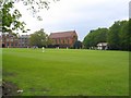
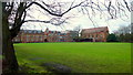
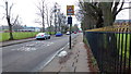
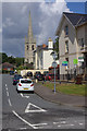
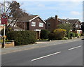
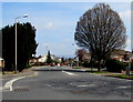
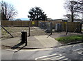
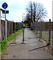
100 photos from this area
Area Information
Key information about the GL51 3LU including its size, population, and administrative classification.
- Area Type
- Postcode
- Area Size
- 1.5 hectares
- Population
- 1327
- Population Density
- 5401 people/km²
House Prices in GL51 3LU
27
Properties
£283,547
Average Sold Price
£145,000
Lowest Price
£530,000
Highest Price
Showing 27 properties
| Address | Type | Beds | Baths | Last Sale Price | Last Sale Date | |
|---|---|---|---|---|---|---|
| 47 Alma Road, Cheltenham, GL51 3LU | Semi-detached | 3 | 2 | £248,000 | Feb 2020 | |
| 51 Alma Road, Cheltenham, GL51 3LU | Terraced | 3 | 2 | £250,000 | Apr 2018 | |
| 33 Alma Road, Cheltenham, GL51 3LU | house | - | - | £530,000 | Jan 2018 | |
| 25 Alma Road, Cheltenham, GL51 3LU | house | 4 | - | £450,000 | Nov 2017 | |
| 27 Alma Road, Cheltenham, GL51 3LU | Detached | 4 | 2 | £343,000 | Jun 2016 | |
| 28A Alma Road, Cheltenham, GL51 3LU | Detached | 8 | 4 | £430,000 | Sep 2015 | |
| 23 Alma Road, Cheltenham, GL51 3LU | house | 4 | - | £420,000 | Aug 2012 | |
| 21 Alma Road, Cheltenham, GL51 3LU | Bungalow | - | - | £190,000 | Oct 2011 | |
| 27A Alma Road, Cheltenham, GL51 3LU | house | 5 | - | £383,000 | Nov 2010 | |
| 37 Alma Road, Cheltenham, GL51 3LU | house | - | - | £242,300 | Jul 2009 |
Page 1 of 3
Energy Efficiency in GL51 3LU
Amenities
Schools
| Rank | School | Type | Entry gender | Ages |
|---|
Explore more schools in this area
Go to Schools tabDemographics
Household Size
Two person
most common
Accommodation Type
Houses
most common
Tenure
61
majority
Ethnic Group
White
most common
Religion
N/A
most common
Household Composition
N/A
most common
Age
47
median
Adults (30-64 years)
most common
Household Deprivation
N/A
with no deprivation
NS-SEC
33
in Lower managerial occupations
Explore more demographic insights in this area
Go to Demographics tabPlanning
Planning Constraints
- Flood RiskPremium
- Ramsar Wetland SitesPremium
- Area of Outstanding Natural BeautyPremium
- Protected Nature ReservePremium
- Protected WoodlandPremium