Area Overview for GL51 3GB
Photos of GL51 3GB
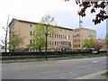
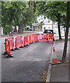
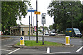
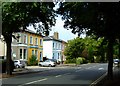

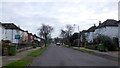
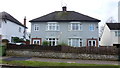
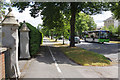
100 photos from this area
Area Information
Key information about the GL51 3GB including its size, population, and administrative classification.
- Area Type
- Postcode
- Area Size
- 4897 m²
- Population
- 1346
- Population Density
- 5567 people/km²
House Prices in GL51 3GB
48
Properties
£164,450
Average Sold Price
£87,000
Lowest Price
£347,500
Highest Price
Showing 48 properties
| Address | Type | Beds | Baths | Last Sale Price | Last Sale Date | |
|---|---|---|---|---|---|---|
| 21, Pegasus Court, St Stephens Road, Cheltenham, GL51 3GB | Flat | - | - | £142,500 | Mar 2025 | |
| 34, Pegasus Court, St Stephens Road, Cheltenham, GL51 3GB | Terraced | 2 | 2 | £315,000 | Feb 2025 | |
| 19, Pegasus Court, St Stephens Road, Cheltenham, GL51 3GB | Flat | 1 | 1 | £120,000 | Feb 2025 | |
| 33, Pegasus Court, St Stephens Road, Cheltenham, GL51 3GB | house | 2 | 1 | £317,600 | Sep 2024 | |
| 32, Pegasus Court, St Stephens Road, Cheltenham, GL51 3GB | Terraced | 2 | 1 | £295,000 | Aug 2024 | |
| 43, Pegasus Court, St Stephens Road, Cheltenham, GL51 3GB | Flat | - | - | £130,000 | Apr 2024 | |
| 17, Pegasus Court, St Stephens Road, Cheltenham, GL51 3GB | Flat | 1 | 1 | £120,000 | Apr 2024 | |
| 4, Pegasus Court, St Stephens Road, Cheltenham, GL51 3GB | Flat | - | - | £142,300 | Nov 2023 | |
| 20, Pegasus Court, St Stephens Road, Cheltenham, GL51 3GB | Flat | 2 | 1 | £165,000 | Oct 2023 | |
| 26, Pegasus Court, St Stephens Road, Cheltenham, GL51 3GB | Flat | - | - | £302,000 | Aug 2023 |
Page 1 of 5
Energy Efficiency in GL51 3GB
Amenities
Schools
| Rank | School | Type | Entry gender | Ages |
|---|
Explore more schools in this area
Go to Schools tabDemographics
Household Size
One person
most common
Accommodation Type
Houses
most common
Tenure
68
majority
Ethnic Group
White
most common
Religion
N/A
most common
Household Composition
N/A
most common
Age
47
median
Adults (30-64 years)
most common
Household Deprivation
N/A
with no deprivation
NS-SEC
51
in Lower managerial occupations
Explore more demographic insights in this area
Go to Demographics tabPlanning
Planning Constraints
- Flood RiskPremium
- Ramsar Wetland SitesPremium
- Area of Outstanding Natural BeautyPremium
- Protected Nature ReservePremium
- Protected WoodlandPremium