Area Overview for GL51 3FB
Photos of GL51 3FB


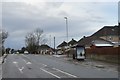


26 photos from this area
Area Information
Key information about the GL51 3FB including its size, population, and administrative classification.
- Area Type
- Postcode
- Area Size
- 7661 m²
- Population
- 1296
- Population Density
- 5369 people/km²
House Prices in GL51 3FB
14
Properties
£305,995
Average Sold Price
£110,000
Lowest Price
£556,000
Highest Price
Showing 14 properties
| Address | Type | Beds | Baths | Last Sale Price | Last Sale Date | |
|---|---|---|---|---|---|---|
| 12 Hidcote Avenue, Up Hatherley, Cheltenham, GL51 3FB | Detached | 4 | 2 | £556,000 | Aug 2023 | |
| 4 Hidcote Avenue, Up Hatherley, Cheltenham, GL51 3FB | Detached | 4 | 2 | £550,000 | Feb 2023 | |
| 8 Hidcote Avenue, Up Hatherley, Cheltenham, GL51 3FB | Detached | 4 | 2 | £352,500 | May 2013 | |
| 5 Hidcote Avenue, Up Hatherley, Cheltenham, GL51 3FB | house | 4 | - | £309,950 | Aug 2011 | |
| 10 Hidcote Avenue, Up Hatherley, Cheltenham, GL51 3FB | house | - | - | £337,500 | Feb 2011 | |
| 11 Hidcote Avenue, Up Hatherley, Cheltenham, GL51 3FB | house | 4 | - | £310,000 | Aug 2010 | |
| 15 Hidcote Avenue, Up Hatherley, Cheltenham, GL51 3FB | Detached | - | - | £315,000 | May 2006 | |
| 1 Hidcote Avenue, Up Hatherley, Cheltenham, GL51 3FB | Detached | - | - | £220,000 | Dec 2002 | |
| 6 Hidcote Avenue, Up Hatherley, Cheltenham, GL51 3FB | Detached | - | - | £175,000 | Mar 2000 | |
| 3 Hidcote Avenue, Up Hatherley, Cheltenham, GL51 3FB | Detached | 5 | 3 | £130,000 | Nov 1997 |
Page 1 of 2
Energy Efficiency in GL51 3FB
Amenities
Schools
| Rank | School | Type | Entry gender | Ages |
|---|
Explore more schools in this area
Go to Schools tabDemographics
Household Size
Family (3-5 people)
most common
Accommodation Type
Houses
most common
Tenure
76
majority
Ethnic Group
White
most common
Religion
N/A
most common
Household Composition
N/A
most common
Age
47
median
Adults (30-64 years)
most common
Household Deprivation
N/A
with no deprivation
NS-SEC
52
in Lower managerial occupations
Explore more demographic insights in this area
Go to Demographics tabPlanning
Planning Constraints
- Flood RiskPremium
- Ramsar Wetland SitesPremium
- Area of Outstanding Natural BeautyPremium
- Protected Nature ReservePremium
- Protected WoodlandPremium