Area Overview for GL51 0WN
Photos of GL51 0WN
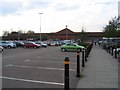
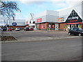
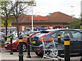
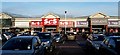
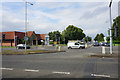
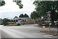
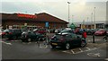
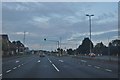
35 photos from this area
Area Information
Key information about the GL51 0WN including its size, population, and administrative classification.
- Area Type
- Postcode
- Area Size
- 1.0 hectares
- Population
- 2237
- Population Density
- 4904 people/km²
House Prices in GL51 0WN
33
Properties
£206,817
Average Sold Price
£70,000
Lowest Price
£320,500
Highest Price
Showing 33 properties
| Address | Type | Beds | Baths | Last Sale Price | Last Sale Date | |
|---|---|---|---|---|---|---|
| 32 Kingfisher Drive, Cheltenham, GL51 0WN | Detached | 1 | 2 | £195,000 | Oct 2025 | |
| 6 Kingfisher Drive, Cheltenham, GL51 0WN | Terraced | 4 | 3 | £277,500 | Jun 2025 | |
| 2 Kingfisher Drive, Cheltenham, GL51 0WN | Terraced | 4 | 3 | £285,000 | Dec 2024 | |
| 3 Kingfisher Drive, Cheltenham, GL51 0WN | Detached | 3 | 2 | £315,000 | Apr 2023 | |
| 8 Kingfisher Drive, Cheltenham, GL51 0WN | Semi-detached | 4 | 2 | £320,500 | Feb 2022 | |
| 17 Kingfisher Drive, Cheltenham, GL51 0WN | house | - | - | £275,000 | Dec 2020 | |
| 14 Kingfisher Drive, Cheltenham, GL51 0WN | Terraced | 5 | 2 | £260,000 | Feb 2020 | |
| 12 Kingfisher Drive, Cheltenham, GL51 0WN | house | 4 | - | £243,500 | Oct 2019 | |
| 40 Kingfisher Drive, Cheltenham, GL51 0WN | Semi-detached | 3 | 2 | £223,500 | Jan 2019 | |
| 36 Kingfisher Drive, Cheltenham, GL51 0WN | Detached | 3 | 2 | £236,000 | Dec 2017 |
Page 1 of 4
Energy Efficiency in GL51 0WN
Amenities
Schools
| Rank | School | Type | Entry gender | Ages |
|---|
Explore more schools in this area
Go to Schools tabDemographics
Household Size
Family (3-5 people)
most common
Accommodation Type
Houses
most common
Tenure
39
majority
Ethnic Group
White
most common
Religion
N/A
most common
Household Composition
N/A
most common
Age
47
median
Adults (30-64 years)
most common
Household Deprivation
N/A
with no deprivation
NS-SEC
26
in Lower managerial occupations
Explore more demographic insights in this area
Go to Demographics tabPlanning
Planning Constraints
- Flood RiskPremium
- Ramsar Wetland SitesPremium
- Area of Outstanding Natural BeautyPremium
- Protected Nature ReservePremium
- Protected WoodlandPremium