Area Overview for GL51 0SJ
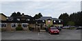
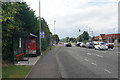
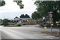
Photos of GL51 0SJ


Area Information
Living in GL51 0SJ offers a compact, residential experience within a small cluster of 1.4 hectares. The area is home to 1,551 residents, spread across a population density of 80 people per square kilometre. This suggests a quiet, low-density environment, ideal for those seeking a peaceful, community-focused lifestyle. The median age of 47 indicates a mature population, with the majority aged between 30 and 64, reflecting a stable demographic. Most homes are owner-occupied, with 76% of residents living in houses rather than flats. The area’s proximity to amenities like Cheltenham Racecourse and nearby rail stations makes it accessible for commuters, while its low crime risk and absence of environmental constraints add to its appeal. Daily life here is likely characterised by a slower pace, with residents benefiting from a mix of local shops, transport links, and a strong sense of local identity.
- Area Type
- Postcode
- Area Size
- 1.4 hectares
- Population
- 1551
- Population Density
- 80 people/km²
GL51 0SJ is a small, owner-occupied area where 76% of residents live in their own homes. The accommodation type is predominantly houses, which is typical for low-density residential zones. This suggests a market skewed towards long-term homeownership rather than rental properties. The limited area size of 1.4 hectares means the housing stock is finite, potentially making the area competitive for buyers. For those seeking a home, the focus is likely on individual properties rather than larger developments. The absence of flats or apartments indicates a traditional, family-friendly housing model, which may appeal to those prioritising space and privacy. Buyers should consider the area’s small size when exploring nearby options.
House Prices in GL51 0SJ
No properties found in this postcode.
Energy Efficiency in GL51 0SJ
Residents of GL51 0SJ have access to a range of amenities within practical reach. Local retail options include Aldi Hester’s, Sainsburys Tewkesbury, and Iceland Cheltenham, ensuring everyday shopping needs are met. The area’s rail stations connect to Cheltenham Spa and Ashchurch, while the Cheltenham Racecourse provides a nearby leisure destination. Although no parks or recreational spaces are explicitly listed, the absence of environmental constraints like protected woodlands or AONBs suggests open spaces may be available nearby. The mix of retail, transport, and leisure options contributes to a convenient, balanced lifestyle, blending practicality with accessibility.
Amenities
Schools
The nearest school to GL51 0SJ is Deerhurst and Apperley Church of England Primary School, which holds an outstanding Ofsted rating. This primary school serves the local community, offering a high standard of education for younger children. The absence of secondary schools in the immediate vicinity means families may need to look beyond GL51 0SJ for secondary education. However, the presence of an outstanding primary school is a strong draw for families with young children, ensuring a solid foundation for early education. The school’s rating reflects a commitment to quality teaching and facilities, which can be a key factor in deciding to settle in the area.
| Rank | School | Type | Entry gender | Ages |
|---|
Explore more schools in this area
Go to Schools tabDemographics
The community in GL51 0SJ is predominantly composed of adults aged 30 to 64, with a median age of 47. This suggests a mature, established population, likely with strong ties to the area. Home ownership is high, with 76% of residents living in their own homes, indicating a stable and long-term resident base. The accommodation type is primarily houses, which aligns with the area’s low density and suburban character. The predominant ethnic group is White, though no further breakdown of diversity is provided. The absence of specific data on deprivation means the area’s socioeconomic profile remains largely unexplored, but the high home ownership rate and stable age range imply a relatively secure and cohesive community.
Household Size
Accommodation Type
Tenure
Ethnic Group
Religion
Household Composition
Age
Household Deprivation
NS-SEC
Explore more demographic insights in this area
Go to Demographics tabPlanning
Planning Constraints
- Flood RiskPremium
- Ramsar Wetland SitesPremium
- Area of Outstanding Natural BeautyPremium
- Protected Nature ReservePremium
- Protected WoodlandPremium