Area Overview for GL51 0RA
Photos of GL51 0RA

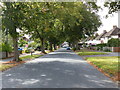
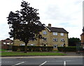
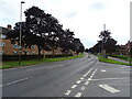
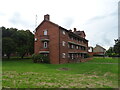

27 photos from this area
Area Information
Key information about the GL51 0RA including its size, population, and administrative classification.
- Area Type
- Postcode
- Area Size
- 5364 m²
- Population
- 1636
- Population Density
- 8031 people/km²
House Prices in GL51 0RA
16
Properties
£167,442
Average Sold Price
£65,000
Lowest Price
£242,000
Highest Price
Showing 16 properties
| Address | Type | Beds | Baths | Last Sale Price | Last Sale Date | |
|---|---|---|---|---|---|---|
| 46 Hesters Way Road, Cheltenham, GL51 0RA | Semi-detached | 3 | 1 | £235,000 | Nov 2023 | |
| 64 Hesters Way Road, Cheltenham, GL51 0RA | Semi-detached | 3 | 1 | £242,000 | Dec 2022 | |
| 56 Hesters Way Road, Cheltenham, GL51 0RA | house | 3 | - | £192,650 | Sep 2021 | |
| 50 Hesters Way Road, Cheltenham, GL51 0RA | house | - | - | £150,000 | Aug 2014 | |
| 68 Hesters Way Road, Cheltenham, GL51 0RA | house | - | - | £120,000 | Feb 2010 | |
| 38 Hesters Way Road, Cheltenham, GL51 0RA | house | - | - | £65,000 | May 2001 | |
| 52 Hesters Way Road, Cheltenham, GL51 0RA | Semi-detached | - | - | - | - | |
| 44 Hesters Way Road, Cheltenham, GL51 0RA | Semi-detached | - | - | - | - | |
| 66 Hesters Way Road, Cheltenham, GL51 0RA | house | - | - | - | - | |
| 60 Hesters Way Road, Cheltenham, GL51 0RA | Semi-detached | - | - | - | - |
Page 1 of 2
Energy Efficiency in GL51 0RA
Amenities
Schools
| Rank | School | Type | Entry gender | Ages |
|---|
Explore more schools in this area
Go to Schools tabDemographics
Household Size
One person
most common
Accommodation Type
Houses
most common
Tenure
36
majority
Ethnic Group
White
most common
Religion
N/A
most common
Household Composition
N/A
most common
Age
47
median
Adults (30-64 years)
most common
Household Deprivation
N/A
with no deprivation
NS-SEC
18
in Lower managerial occupations
Explore more demographic insights in this area
Go to Demographics tabPlanning
Planning Constraints
- Flood RiskPremium
- Ramsar Wetland SitesPremium
- Area of Outstanding Natural BeautyPremium
- Protected Nature ReservePremium
- Protected WoodlandPremium