Area Overview for GL51 0BX
Photos of GL51 0BX

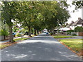
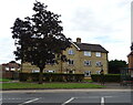
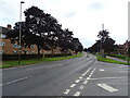
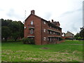

27 photos from this area
Area Information
Key information about the GL51 0BX including its size, population, and administrative classification.
- Area Type
- Postcode
- Area Size
- 9279 m²
- Population
- 1636
- Population Density
- 8031 people/km²
House Prices in GL51 0BX
36
Properties
£134,050
Average Sold Price
£41,500
Lowest Price
£235,000
Highest Price
Showing 36 properties
| Address | Type | Beds | Baths | Last Sale Price | Last Sale Date | |
|---|---|---|---|---|---|---|
| 36 Barbridge Road, Cheltenham, GL51 0BX | Terraced | 3 | 1 | £235,000 | May 2022 | |
| 32 Barbridge Road, Cheltenham, GL51 0BX | house | - | - | £180,000 | May 2018 | |
| 24 Barbridge Road, Cheltenham, GL51 0BX | house | 3 | 1 | £151,500 | Jan 2016 | |
| 20 Barbridge Road, Cheltenham, GL51 0BX | Terraced | 3 | 1 | £162,000 | Nov 2015 | |
| 10 Barbridge Road, Cheltenham, GL51 0BX | Terraced | 2 | 1 | £130,000 | Dec 2014 | |
| 26 Barbridge Road, Cheltenham, GL51 0BX | Terraced | 3 | 1 | £90,000 | Nov 2011 | |
| 40 Barbridge Road, Cheltenham, GL51 0BX | Terraced | - | - | £148,500 | May 2007 | |
| 48 Barbridge Road, Cheltenham, GL51 0BX | Semi-detached | - | - | £119,995 | Nov 2005 | |
| 50 Barbridge Road, Cheltenham, GL51 0BX | Semi-detached | 3 | 1 | £82,000 | Dec 2003 | |
| 52 Barbridge Road, Cheltenham, GL51 0BX | Semi-detached | - | - | £41,500 | Sep 1996 |
Page 1 of 4
Energy Efficiency in GL51 0BX
Amenities
Schools
| Rank | School | Type | Entry gender | Ages |
|---|
Explore more schools in this area
Go to Schools tabDemographics
Household Size
One person
most common
Accommodation Type
Houses
most common
Tenure
36
majority
Ethnic Group
White
most common
Religion
N/A
most common
Household Composition
N/A
most common
Age
47
median
Adults (30-64 years)
most common
Household Deprivation
N/A
with no deprivation
NS-SEC
18
in Lower managerial occupations
Explore more demographic insights in this area
Go to Demographics tabPlanning
Planning Constraints
- Flood RiskPremium
- Ramsar Wetland SitesPremium
- Area of Outstanding Natural BeautyPremium
- Protected Nature ReservePremium
- Protected WoodlandPremium