Area Overview for GL50 4EZ
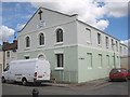
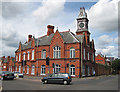
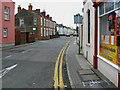
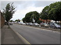
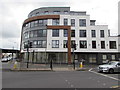
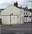
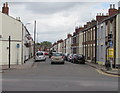
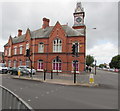
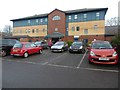
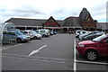
Photos of GL50 4EZ


Area Information
Living in GL50 4EZ offers a distinct experience within a defined residential cluster. This specific postcode covers an area of 4,689 square metres, creating a tightly knit environment where neighbours are often close by. The location houses 1,827 residents, resulting in a high population density of 389,606 people per square kilometre. This compact size means that daily life in GL50 4EZ is characterised by proximity and a sense of place rather than sprawling distances. You will find that the area functions as a small, concentrated community where local interactions are more immediate. Homes in this specific postcode are situated in close quarters, fostering a neighbourhood where the rhythm of daily life is dictated by the immediate surroundings. The environment is defined by its density, ensuring that amenities and streets are within quick reach of every household. For those considering living in GL50 4EZ, the reality is an experience of living within a clearly bounded space where the community is self-contained and accessible. The small footprint of the area suggests a residential setting where the focus is strictly on housing needs for the local population.
- Area Type
- Postcode
- Area Size
- 4689 m²
- Population
- 1827
- Population Density
- 14663 people/km²
The property market in GL50 4EZ presents a clear picture of a housing stock dominated by rental activity. Data indicates that 32% of households are owners, meaning the remaining 68% of residents do not own their homes. This skewed ratio suggests that the area functions largely as a rental market, catering heavily to tenants rather than long-term owner-occupiers. The predominant accommodation type in the area consists of houses, offering standalone living spaces which aligns with the demographic of young adults. Given the high population density of 389,606 people per square kilometre within this small 4,689 square metre cluster, demand for housing is likely intense. You should expect that housing availability may be competitive, especially for renters looking for secure tenancies near this postcode. The mix of owner and tenant households indicates a dynamic market where properties change hands frequently or between landlords and occupants. For buyers looking at homes in GL50 4EZ, the market dynamics suggest a focus on investment potential or purchasing into a young, transient community. The low ownership rate of just over one-third of households underscores the importance of understanding the rental landscape before committing to a purchase.
House Prices in GL50 4EZ
Showing 6 properties
| Address | Type | Beds | Baths | Last Sale Price | Last Sale Date | |
|---|---|---|---|---|---|---|
| 53 St Pauls Road, Cheltenham, GL50 4EZ | Terraced | 5 | - | £220,000 | Jun 2019 | |
| 55 St Pauls Road, Cheltenham, GL50 4EZ | Terraced | 5 | 2 | £140,000 | Jan 2009 | |
| 51 St Pauls Road, Cheltenham, GL50 4EZ | house | 1 | 2 | £43,500 | Dec 1996 | |
| 49A St Pauls Road, Cheltenham, GL50 4EZ | Terraced | 3 | 1 | - | - | |
| St Pauls Church Centre, St Pauls Road, Cheltenham, GL50 4EZ | commercial | - | - | - | - | |
| 57A St Pauls Road, Cheltenham, GL50 4EZ | Retail | - | - | - | - |
Energy Efficiency in GL50 4EZ
Your lifestyle in GL50 4EZ is supported by a range of practical amenities within easy reach. For retail needs, there are five notable options closest to your home, including Lidl Swindon and two instances of Tesco Cheltenham outlets mentioned in local listings. These supermarkets ensure that daily grocery shopping is convenient and accessible. Transport links are well-established, with Cheltenham Spa Railway Station providing rail access from the immediate vicinity. For leisure and recreation, the area is close to Gotherington and Cheltenham Racecourse, offering cultural and sporting options. Additionally, three airports in the broader region, identified as Gloucestershire Airport in the vicinity, provide travel connectivity for longer journeys. The presence of these facilities means you do not need to travel far for essential services or entertainment. Shopping at Tesco Cheltenham or Lidl Swindon is a short trip away, fitting easily into a weekly schedule. The proximity to transport hubs like the railway station and racecourse integrates leisure and commuting into your daily routine. Living in GL50 4EZ gives you direct access to the retail and transport network needed for a balanced life.
Amenities
Schools
| Rank | School | Type | Entry gender | Ages |
|---|
Explore more schools in this area
Go to Schools tabDemographics
The community in GL50 4EZ reflects a youthful and dynamic demographic profile. The median age for residents is 22 years, with the most common age range being young adults aged between 15 and 29. You will find that the area is predominantly inhabited by individuals in this younger bracket, suggesting a location popular with students or those early in their careers. Regarding home ownership, only 32% of households own their property outright. This relatively low figure indicates that the majority of people are either renting or on a path to purchase, which often correlates with lower-income brackets or temporary residency status. The predominant ethnic group in the area is White, which constitutes the majority of the population. Accommodation types in GL50 4EZ consist primarily of houses, aligning with the demographic of young adults seeking independent living spaces. The social fabric is shaped by this concentration of young people, creating a community where lifestyle choices and social habits may reflect the energy and aspirations of this age group. The housing stock mirrors the needs of this population, prioritising standalone houses over other forms of accommodation.
Household Size
Accommodation Type
Tenure
Ethnic Group
Religion
Household Composition
Age
Household Deprivation
NS-SEC
Explore more demographic insights in this area
Go to Demographics tabPlanning
Planning Constraints
- Flood RiskPremium
- Ramsar Wetland SitesPremium
- Area of Outstanding Natural BeautyPremium
- Protected Nature ReservePremium
- Protected WoodlandPremium