Area Overview for GL50 3BU
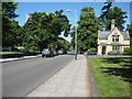
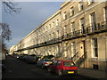
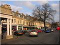
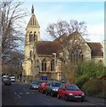
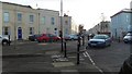
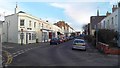
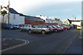
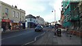
Photos of GL50 3BU


Area Information
Living in GL50 3BU means being part of a small, tightly knit residential cluster in England, home to 1,365 people. This area is defined by its compact nature, with a focus on practical living rather than sprawling development. The community is predominantly made up of adults aged 30–64, reflecting a mature demographic that likely values stability and proximity to amenities. Daily life here is shaped by the balance between local services and broader connectivity. While the area itself is small, it sits near larger hubs like Cheltenham, offering access to retail, transport, and cultural offerings. The presence of nearby supermarkets such as Co-op Montpelier and Waitrose Cheltenham ensures everyday convenience, while the Cheltenham Spa Railway Station provides a direct link to regional travel. For those seeking a quieter lifestyle, GL50 3BU offers a sense of calm, though it remains within reach of the dynamic energy of nearby towns.
- Area Type
- Postcode
- Area Size
- Not available
- Population
- 1365
- Population Density
- 5200 people/km²
The property market in GL50 3BU is characterised by a low home ownership rate of 36%, suggesting that most properties are rented rather than owner-occupied. The accommodation type is predominantly flats, which is typical for smaller residential clusters with limited space for larger homes. This dynamic indicates a rental market that caters to individuals or couples seeking manageable, low-maintenance housing. Buyers considering this area should note the small size of GL50 3BU itself, which may mean limited options for purchase. The focus on flats also implies that the surrounding areas are likely to have similar housing stock, making it a niche market for those prioritising convenience over property value growth. For those seeking a home, the area’s compact nature means proximity to amenities is a key selling point, though availability may be constrained by the small population and limited development.
House Prices in GL50 3BU
No properties found in this postcode.
Energy Efficiency in GL50 3BU
Residents of GL50 3BU have access to a range of amenities within practical reach. Nearby supermarkets include Co-op Montpelier, Waitrose Cheltenham, and Sainsburys Cheltenham, ensuring daily shopping needs are met. The Cheltenham Spa Railway Station provides easy access to regional travel, while metro points like Cheltenham Racecourse and Gotherington offer alternative transport routes. Three Gloucestershire Airport locations are also nearby, though their specific functions are unclear. The presence of these amenities contributes to a lifestyle that balances convenience with a quieter, more localised environment. While the area itself is small, its proximity to larger hubs ensures residents can enjoy both the benefits of a tight-knit community and the vibrancy of nearby towns.
Amenities
Schools
| Rank | School | Type | Entry gender | Ages |
|---|
Explore more schools in this area
Go to Schools tabDemographics
The population of GL50 3BU is 1,365, with a median age of 47, indicating a community skewed toward middle-aged adults. The most common age range is 30–64 years, suggesting a mature, settled population. Home ownership here is relatively low at 36%, meaning the majority of residents are likely renters. The predominant accommodation type is flats, which aligns with the area’s compact layout and smaller housing stock. The predominant ethnic group is White, though no specific data on diversity or deprivation is provided. This demographic profile implies a community focused on stability and practicality, with fewer young families or transient populations. The low home ownership rate may reflect limited opportunities for property investment or a preference for rental living in a small, established area.
Household Size
Accommodation Type
Tenure
Ethnic Group
Religion
Household Composition
Age
Household Deprivation
NS-SEC
Explore more demographic insights in this area
Go to Demographics tabPlanning
Planning Constraints
- Flood RiskPremium
- Ramsar Wetland SitesPremium
- Area of Outstanding Natural BeautyPremium
- Protected Nature ReservePremium
- Protected WoodlandPremium