Area Overview for GL50 2ZU
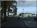
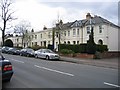
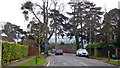
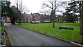
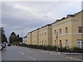
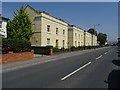
Photos of GL50 2ZU


Area Information
Living in GL50 2ZU offers a quiet, residential experience within a small cluster of homes serving a population of 1,673. This area is characterised by its mature demographic, with a median age of 47 and a strong presence of adults aged 30–64. The community is predominantly owner-occupied, with 71% of homes in private ownership, and most properties are houses rather than flats. Proximity to St James’ Church of England Primary School, rated ‘good’ by Ofsted, and the University of Gloucestershire suggests a mix of family-oriented and academic environments. Daily life here balances local amenities with easy access to transport links, including Cheltenham Spa Railway Station and nearby metro points. The area benefits from excellent broadband connectivity, scoring 98 out of 100, and a crime risk score of 81, indicating a safer neighbourhood. With no environmental constraints like protected woodlands or AONB designations, GL50 2ZU provides a straightforward, low-risk living environment for those seeking stability and practicality.
- Area Type
- Postcode
- Area Size
- Not available
- Population
- 1673
- Population Density
- 3625 people/km²
GL50 2ZU is primarily an owner-occupied area, with 71% of homes in private hands, and the housing stock is predominantly composed of houses rather than flats. This suggests a market skewed towards family homes and long-term residency, with fewer rental properties. The small size of the area means the property landscape is limited, but the focus on houses indicates potential for larger, more traditional homes. For buyers, this environment offers stability, as the high home ownership rate often correlates with lower turnover. However, the limited number of properties may mean fewer options for buyers seeking immediate purchases. Proximity to educational institutions and transport links adds value, though the area’s size means surrounding neighborhoods would need to be considered for broader property searches.
House Prices in GL50 2ZU
No properties found in this postcode.
Energy Efficiency in GL50 2ZU
The lifestyle in GL50 2ZU is supported by a range of amenities within reach. Retail options include Cook Cheltenham, Co-op Bath, and Sainsburys Cheltenham, offering everyday shopping needs. The Cheltenham Spa Railway Station and nearby metro points provide access to rail and regional transport, while three Gloucestershire Airports cater to those requiring air travel. Though the area is small, its proximity to these services ensures convenience for daily tasks and leisure. The presence of a primary school with a good Ofsted rating and the University of Gloucestershire adds to the area’s appeal for families and students. The blend of retail, transport, and educational facilities contributes to a balanced, practical living experience.
Amenities
Schools
Near GL50 2ZU, St James’ Church of England Primary School is a key educational institution, offering primary education with an Ofsted rating of ‘good’. This school is listed twice in the data, likely due to duplicate entries, but its presence underscores the area’s appeal for families. The University of Gloucestershire, though classified as ‘other’, provides higher education opportunities nearby. The mix of primary and higher education options suggests a community that supports both children and students. Families in GL50 2ZU benefit from a local primary school with a solid rating, reducing the need for long commutes, while the university caters to those seeking further study or research opportunities.
| Rank | School | Type | Entry gender | Ages |
|---|
Explore more schools in this area
Go to Schools tabDemographics
The population of GL50 2ZU is 1,673, with a median age of 47, reflecting a mature community where adults aged 30–64 form the largest age group. Home ownership is high at 71%, and the area is dominated by houses rather than flats, suggesting a preference for larger, family-friendly properties. The predominant ethnic group is White, which aligns with broader regional demographics. This age profile indicates a stable, long-term resident base, with fewer young families or students compared to other areas. The absence of specific deprivation data means quality of life is inferred from low crime rates and good infrastructure. The demographic mix supports a community focused on established living, with limited turnover and a strong sense of local identity.
Household Size
Accommodation Type
Tenure
Ethnic Group
Religion
Household Composition
Age
Household Deprivation
NS-SEC
Explore more demographic insights in this area
Go to Demographics tabPlanning
Planning Constraints
- Flood RiskPremium
- Ramsar Wetland SitesPremium
- Area of Outstanding Natural BeautyPremium
- Protected Nature ReservePremium
- Protected WoodlandPremium