Area Overview for GL50 2QB
Photos of GL50 2QB


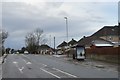


26 photos from this area
Area Information
Key information about the GL50 2QB including its size, population, and administrative classification.
- Area Type
- Postcode
- Area Size
- 1.1 hectares
- Population
- 1673
- Population Density
- 3625 people/km²
House Prices in GL50 2QB
17
Properties
£587,700
Average Sold Price
£197,000
Lowest Price
£1,050,000
Highest Price
Showing 17 properties
| Address | Type | Beds | Baths | Last Sale Price | Last Sale Date | |
|---|---|---|---|---|---|---|
| 12 Kemerton Road, Cheltenham, GL50 2QB | house | 4 | 2 | £1,050,000 | Feb 2025 | |
| 9 Kemerton Road, Cheltenham, GL50 2QB | Detached | 5 | - | £795,000 | Apr 2016 | |
| 18 Kemerton Road, Cheltenham, GL50 2QB | Detached | 5 | - | £810,000 | Jul 2014 | |
| 3 Kemerton Road, Cheltenham, GL50 2QB | Detached | 5 | - | £685,000 | Mar 2014 | |
| 6 Kemerton Road, Cheltenham, GL50 2QB | Detached | 5 | - | £550,000 | Nov 2007 | |
| 5 Kemerton Road, Cheltenham, GL50 2QB | Detached | - | - | £525,000 | Mar 2006 | |
| 16 Kemerton Road, Cheltenham, GL50 2QB | Detached | 5 | 3 | £640,000 | Jan 2005 | |
| 14 Kemerton Road, Cheltenham, GL50 2QB | Detached | - | - | £425,000 | Feb 2003 | |
| 7 Kemerton Road, Cheltenham, GL50 2QB | Detached | - | - | £197,000 | Nov 1995 | |
| 1 Kemerton Road, Cheltenham, GL50 2QB | Detached | 4 | 2 | £200,000 | Sep 1995 |
Page 1 of 2
Energy Efficiency in GL50 2QB
Amenities
Schools
| Rank | School | Type | Entry gender | Ages |
|---|
Explore more schools in this area
Go to Schools tabDemographics
Household Size
One person
most common
Accommodation Type
Houses
most common
Tenure
71
majority
Ethnic Group
White
most common
Religion
N/A
most common
Household Composition
N/A
most common
Age
47
median
Adults (30-64 years)
most common
Household Deprivation
N/A
with no deprivation
NS-SEC
49
in Lower managerial occupations
Explore more demographic insights in this area
Go to Demographics tabPlanning
Planning Constraints
- Flood RiskPremium
- Ramsar Wetland SitesPremium
- Area of Outstanding Natural BeautyPremium
- Protected Nature ReservePremium
- Protected WoodlandPremium