Area Overview for GL50 2EX
Photos of GL50 2EX
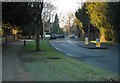
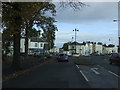
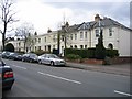
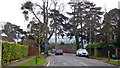
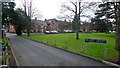
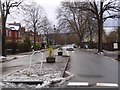
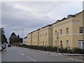
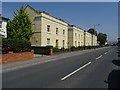
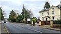
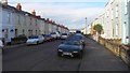
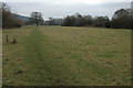
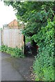
45 photos from this area
Area Information
Key information about the GL50 2EX including its size, population, and administrative classification.
- Area Type
- Postcode
- Area Size
- 1.6 hectares
- Population
- 1673
- Population Density
- 3625 people/km²
House Prices in GL50 2EX
25
Properties
£910,045
Average Sold Price
£215,000
Lowest Price
£1,410,000
Highest Price
Showing 25 properties
| Address | Type | Beds | Baths | Last Sale Price | Last Sale Date | |
|---|---|---|---|---|---|---|
| 101 Painswick Road, Cheltenham, GL50 2EX | Bungalow | 3 | 2 | £1,150,000 | Aug 2025 | |
| 99 Painswick Road, Cheltenham, GL50 2EX | Detached | 4 | 2 | £1,200,000 | Nov 2021 | |
| 77 Painswick Road, Cheltenham, GL50 2EX | house | - | - | £1,050,000 | Jun 2021 | |
| 79 Painswick Road, Cheltenham, GL50 2EX | house | - | - | £1,410,000 | Mar 2021 | |
| 75 Painswick Road, Cheltenham, GL50 2EX | house | - | - | £1,270,000 | Dec 2020 | |
| 81 Painswick Road, Cheltenham, GL50 2EX | Detached | 6 | 3 | £1,350,000 | Jul 2019 | |
| 69 Painswick Road, Cheltenham, GL50 2EX | Semi-detached | 6 | 3 | £800,000 | Jun 2017 | |
| 97 Painswick Road, Cheltenham, GL50 2EX | house | - | - | £525,500 | Mar 2010 | |
| 73 Painswick Road, Cheltenham, GL50 2EX | Semi-detached | - | - | £820,000 | Sep 2006 | |
| 85 Painswick Road, Cheltenham, GL50 2EX | Terraced | 5 | - | £215,000 | Aug 1999 |
Page 1 of 3
Energy Efficiency in GL50 2EX
Amenities
Schools
| Rank | School | Type | Entry gender | Ages |
|---|
Explore more schools in this area
Go to Schools tabDemographics
Household Size
One person
most common
Accommodation Type
Houses
most common
Tenure
71
majority
Ethnic Group
White
most common
Religion
N/A
most common
Household Composition
N/A
most common
Age
47
median
Adults (30-64 years)
most common
Household Deprivation
N/A
with no deprivation
NS-SEC
49
in Lower managerial occupations
Explore more demographic insights in this area
Go to Demographics tabPlanning
Planning Constraints
- Flood RiskPremium
- Ramsar Wetland SitesPremium
- Area of Outstanding Natural BeautyPremium
- Protected Nature ReservePremium
- Protected WoodlandPremium