Area Overview for GL5 5DD
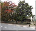
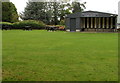
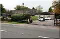
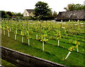
Photos of GL5 5DD
Area Information
Living in GL5 5DD offers a compact, residential experience shaped by its small area size of 7,048 square metres and a population of 1,030 people. The postcode covers a tightly knit cluster of homes, with a population density of 547 people per square kilometre. This suggests a close-knit community where daily life is likely centred around local amenities and familiar faces. The area is predominantly occupied by homeowners, with 90% of properties owned by residents, and the majority of homes are traditional houses rather than flats. Nearby, Stroud Railway Station and Stonehouse Railway Station provide practical transport links, while Bownham Park School, a special school, serves the educational needs of the area. Life here is likely quiet and stable, with minimal environmental constraints such as no protected woodlands or Ramsar wetlands nearby. The low crime risk score of 83 further reinforces the area’s safety, making it appealing for those prioritising security and a relaxed pace of life.
- Area Type
- Postcode
- Area Size
- 7048 m²
- Population
- 1030
- Population Density
- 547 people/km²
The property market in GL5 5DD is dominated by owner-occupied homes, with 90% of properties owned by residents rather than rented. This reflects a community where long-term residency is common, and the housing stock is primarily composed of traditional houses. The small area size of 7,048 square metres means the market is limited in scale, with few properties available for purchase or rent. Buyers should expect a focus on single-family homes, which may appeal to those seeking space and privacy. The absence of flats or high-density housing suggests the area is not suited to those prioritising urban living or rental investment. For those considering the area, the compact nature of GL5 5DD means proximity to nearby towns like Stroud and Stonehouse could be critical for access to broader property options or amenities.
House Prices in GL5 5DD
No properties found in this postcode.
Energy Efficiency in GL5 5DD
Residents of GL5 5DD have access to a modest selection of retail amenities, including Aldi Bath Road, Waitrose Stroud, and Iceland Stroud, all within practical reach. These shops provide essential grocery and household services, reducing the need for long trips to larger centres. The two nearby railway stations—Stroud and Stonehouse—enhance mobility, connecting the area to broader transport networks. While the data does not mention parks or leisure facilities, the absence of protected natural areas suggests open spaces may be limited. The combination of local retail and transport links creates a functional lifestyle, though those seeking extensive recreational options may need to explore nearby towns.
Amenities
Schools
The nearest school to GL5 5DD is Bownham Park School, a special school catering to students with specific educational needs. While no Ofsted rating is provided, the presence of a dedicated special school indicates the area’s focus on supporting diverse educational requirements. Families with children requiring specialist provision may find this a key advantage, though those seeking mainstream schooling will need to look further afield. The lack of other schools in the immediate vicinity suggests that parents may need to travel to nearby towns for primary or secondary education. This could be a consideration for homebuyers prioritising proximity to a full range of educational institutions.
| Rank | School | Type | Entry gender | Ages |
|---|---|---|---|---|
| 1 | Bownham Park School | special | N/A | N/A |
Explore more schools in this area
Go to Schools tabDemographics
The community in GL5 5DD is characterised by a median age of 47, with the most common age range being adults aged 30–64. This suggests a mature, established population, many of whom may be long-term residents. Home ownership is exceptionally high at 90%, indicating a strong preference for property investment over rental living. The area is predominantly occupied by houses, reflecting a preference for larger, private living spaces. The predominant ethnic group is White, with no data provided on other demographics. The absence of specific deprivation data means the quality of life cannot be assessed in terms of economic hardship, but the high home ownership rate and low crime risk imply stability. The population density of 547 people per square kilometre suggests a balance between residential space and community interaction, without the congestion of larger urban areas.
Household Size
Accommodation Type
Tenure
Ethnic Group
Religion
Household Composition
Age
Household Deprivation
NS-SEC
Explore more demographic insights in this area
Go to Demographics tabPlanning
Planning Constraints
- Flood RiskPremium
- Ramsar Wetland SitesPremium
- Area of Outstanding Natural BeautyPremium
- Protected Nature ReservePremium
- Protected WoodlandPremium
- Crime RiskPremium