Area Overview for GL5 2RH
Photos of GL5 2RH
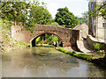
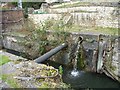
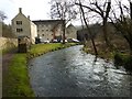
![Thames & Severn Canal culverted [1] in GL5 2RH](https://images.propbar.co.uk/images/geograph/48/93/4893531_120.jpg)
56 photos from this area
Area Information
Key information about the GL5 2RH including its size, population, and administrative classification.
- Area Type
- Postcode
- Area Size
- 1.5 hectares
- Population
- 1290
- Population Density
- 404 people/km²
House Prices in GL5 2RH
4
Properties
£209,000
Average Sold Price
£200,000
Lowest Price
£218,000
Highest Price
Showing 4 properties
| Address | Type | Beds | Baths | Last Sale Price | Last Sale Date | |
|---|---|---|---|---|---|---|
| 1, The Laurels, Bourne Lane, Brimscombe, GL5 2RH | Semi-detached | - | - | £200,000 | Oct 2008 | |
| 2, The Laurels, Bourne Lane, Brimscombe, GL5 2RH | Detached | 4 | 2 | £218,000 | Apr 2005 | |
| Beulah Cottage, Bourne Lane, Brimscombe, GL5 2RH | Detached | 4 | 2 | - | - | |
| Fairview, Bourne Lane, Brimscombe, GL5 2RH | Semi-detached | - | - | - | - |
Energy Efficiency in GL5 2RH
Amenities
Schools
| Rank | School | Type | Entry gender | Ages |
|---|
Explore more schools in this area
Go to Schools tabDemographics
Household Size
Two person
most common
Accommodation Type
Houses
most common
Tenure
82
majority
Ethnic Group
White
most common
Religion
N/A
most common
Household Composition
N/A
most common
Age
47
median
Adults (30-64 years)
most common
Household Deprivation
N/A
with no deprivation
NS-SEC
43
in Lower managerial occupations
Explore more demographic insights in this area
Go to Demographics tabPlanning
Planning Constraints
- Flood RiskPremium
- Ramsar Wetland SitesPremium
- Area of Outstanding Natural BeautyPremium
- Protected Nature ReservePremium
- Protected WoodlandPremium