Area Overview for GL5 1TG
Photos of GL5 1TG

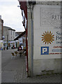
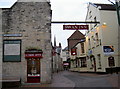

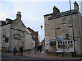


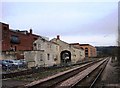


100 photos from this area
Area Information
Key information about the GL5 1TG including its size, population, and administrative classification.
- Area Type
- Postcode
- Area Size
- 3378 m²
- Population
- 2072
- Population Density
- 1051 people/km²
House Prices in GL5 1TG
14
Properties
£211,421
Average Sold Price
£40,000
Lowest Price
£425,000
Highest Price
Showing 14 properties
| Address | Type | Beds | Baths | Last Sale Price | Last Sale Date | |
|---|---|---|---|---|---|---|
| Roslyn, Middle Street, Uplands, Stroud, GL5 1TG | Semi-detached | 3 | 1 | £425,000 | Oct 2025 | |
| Thalia, Middle Street, Uplands, Stroud, GL5 1TG | Cottage | 3 | - | £220,000 | Jun 2013 | |
| Lavender Cottage, Middle Street, Uplands, Stroud, GL5 1TG | house | 4 | - | £272,000 | Apr 2010 | |
| Pilgrim Cottage, Middle Street, Uplands, Stroud, GL5 1TG | Detached | - | - | £250,000 | Jun 2004 | |
| Hope Cottage, Middle Street, Uplands, Stroud, GL5 1TG | Detached | - | - | £193,000 | Feb 2003 | |
| Fernside, Middle Street, Uplands, Stroud, GL5 1TG | Terraced | - | - | £79,950 | May 2001 | |
| 1, Rock Cottages, Middle Street, Uplands, Stroud, GL5 1TG | house | 2 | - | £40,000 | Apr 1995 | |
| 3, Rock Cottages, Middle Street, Uplands, Stroud, GL5 1TG | Terraced | 2 | 1 | - | - | |
| Iddesleigh, Middle Street, Uplands, Stroud, GL5 1TG | Detached | 2 | - | - | - | |
| The Old Garden, Middle Street, Uplands, Stroud, GL5 1TG | Detached | - | - | - | - |
Page 1 of 2
Energy Efficiency in GL5 1TG
Amenities
Schools
| Rank | School | Type | Entry gender | Ages |
|---|
Explore more schools in this area
Go to Schools tabDemographics
Household Size
One person
most common
Accommodation Type
Houses
most common
Tenure
69
majority
Ethnic Group
White
most common
Religion
N/A
most common
Household Composition
N/A
most common
Age
47
median
Adults (30-64 years)
most common
Household Deprivation
N/A
with no deprivation
NS-SEC
34
in Lower managerial occupations
Explore more demographic insights in this area
Go to Demographics tabPlanning
Planning Constraints
- Flood RiskPremium
- Ramsar Wetland SitesPremium
- Area of Outstanding Natural BeautyPremium
- Protected Nature ReservePremium
- Protected WoodlandPremium