Area Overview for GL5 1RB
Photos of GL5 1RB
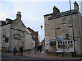
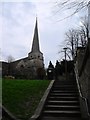

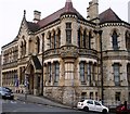
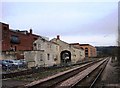
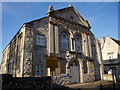
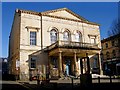
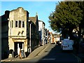
100 photos from this area
Area Information
Key information about the GL5 1RB including its size, population, and administrative classification.
- Area Type
- Postcode
- Area Size
- 6796 m²
- Population
- 2468
- Population Density
- 2249 people/km²
House Prices in GL5 1RB
7
Properties
£233,200
Average Sold Price
£84,000
Lowest Price
£417,500
Highest Price
Showing 7 properties
| Address | Type | Beds | Baths | Last Sale Price | Last Sale Date | |
|---|---|---|---|---|---|---|
| The New Bungalow, Sycamore Drive, Stroud, GL5 1RB | Bungalow | 3 | 2 | £417,500 | May 2022 | |
| Applegarth, Sycamore Drive, Stroud, GL5 1RB | Bungalow | 3 | 1 | £250,000 | Jul 2006 | |
| Rye Eira, Sycamore Drive, Stroud, GL5 1RB | Detached | - | - | £199,500 | Apr 2004 | |
| Cumbrae, Sycamore Drive, Stroud, GL5 1RB | Detached | 3 | 2 | £215,000 | Aug 2002 | |
| Cherry Orchard, Sycamore Drive, Stroud, GL5 1RB | Detached | - | - | £84,000 | May 1996 | |
| Sunnyside, Sycamore Drive, Stroud, GL5 1RB | Detached | - | - | - | - | |
| Hazeldine, Sycamore Drive, Stroud, GL5 1RB | Detached | - | - | - | - |
Energy Efficiency in GL5 1RB
Amenities
Schools
| Rank | School | Type | Entry gender | Ages |
|---|
Explore more schools in this area
Go to Schools tabDemographics
Household Size
One person
most common
Accommodation Type
Houses
most common
Tenure
63
majority
Ethnic Group
White
most common
Religion
N/A
most common
Household Composition
N/A
most common
Age
47
median
Adults (30-64 years)
most common
Household Deprivation
N/A
with no deprivation
NS-SEC
38
in Lower managerial occupations
Explore more demographic insights in this area
Go to Demographics tabPlanning
Planning Constraints
- Flood RiskPremium
- Ramsar Wetland SitesPremium
- Area of Outstanding Natural BeautyPremium
- Protected Nature ReservePremium
- Protected WoodlandPremium