Area Overview for GL4 8ED
Photos of GL4 8ED

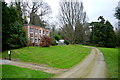
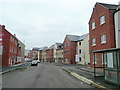
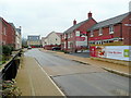


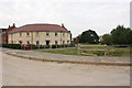


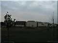
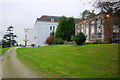

16 photos from this area
Area Information
Key information about the GL4 8ED including its size, population, and administrative classification.
- Area Type
- Postcode
- Area Size
- 33.3 hectares
- Population
- 2000
- Population Density
- 95 people/km²
House Prices in GL4 8ED
21
Properties
£443,286
Average Sold Price
£175,000
Lowest Price
£950,000
Highest Price
Showing 21 properties
| Address | Type | Beds | Baths | Last Sale Price | Last Sale Date | |
|---|---|---|---|---|---|---|
| 1, Cannons Court, Bondend Road, Upton St Leonards, GL4 8ED | Semi-detached | 4 | 2 | £950,000 | Jan 2025 | |
| 2, Cannons Court, Bondend Road, Upton St Leonards, GL4 8ED | Semi-detached | 4 | 2 | £620,000 | Apr 2021 | |
| 81 Bondend Road, Upton St Leonards, GL4 8ED | Semi-detached | - | - | £400,000 | Jan 2009 | |
| 83 Bondend Road, Upton St Leonards, GL4 8ED | Terraced | 4 | 2 | £175,000 | Mar 2006 | |
| Old Home Farm House, Bondend Road, Upton St Leonards, GL4 8ED | house | - | - | £550,000 | Apr 2005 | |
| Warnless Close, Bondend Road, Upton St Leonards, GL4 8ED | Semi-detached | - | - | £213,000 | Nov 2001 | |
| Bowden Hall Farm, Bondend Road, Upton St Leonards, GL4 8ED | Detached | - | - | £195,000 | Dec 1995 | |
| 3, Cannons Court, Bondend Road, Upton St Leonards, GL4 8ED | Semi-detached | 3 | 2 | - | - | |
| Tudor Cottage, Bondend Road, Upton St Leonards, GL4 8ED | Cottage | 2 | 1 | - | - | |
| The Barn, Cannons Court, Bondend Road, Upton St Leonards, GL4 8ED | Detached | 5 | 3 | - | - |
Page 1 of 3
Energy Efficiency in GL4 8ED
Amenities
Schools
| Rank | School | Type | Entry gender | Ages |
|---|
Explore more schools in this area
Go to Schools tabDemographics
Household Size
Two person
most common
Accommodation Type
Houses
most common
Tenure
85
majority
Ethnic Group
White
most common
Religion
N/A
most common
Household Composition
N/A
most common
Age
47
median
Adults (30-64 years)
most common
Household Deprivation
N/A
with no deprivation
NS-SEC
44
in Lower managerial occupations
Explore more demographic insights in this area
Go to Demographics tabPlanning
Planning Constraints
- Flood RiskPremium
- Ramsar Wetland SitesPremium
- Area of Outstanding Natural BeautyPremium
- Protected Nature ReservePremium
- Protected WoodlandPremium