Area Overview for GL4 7YZ
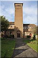
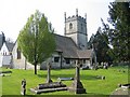
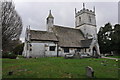
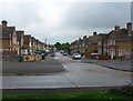
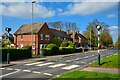
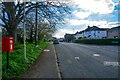
Photos of GL4 7YZ


Area Information
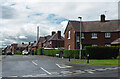
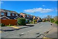
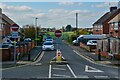
Living in GL4 7YZ offers a compact, densely populated residential experience, with 1,957 residents spread across a small cluster of homes. The area’s population density of 1,132 people per square kilometre suggests a tightly knit community, likely centred around local amenities and schools. This postcode is a microcosm of mid-sized family homes, with a median age of 47 and a strong presence of adults aged 30–64. Daily life here is shaped by proximity to essential services, including two railway stations and multiple retail outlets. The area’s small size means residents are close to key facilities, though the limited space may foster a sense of familiarity among neighbours. With 71% of homes owned outright, the community leans towards long-term residents rather than renters. While the area lacks natural beauty designations, its practical layout and accessibility to transport networks make it a viable choice for those prioritising convenience over scenic surroundings.
- Area Type
- Postcode
- Area Size
- Not available
- Population
- 1957
- Population Density
- 1132 people/km²
The property market in GL4 7YZ is characterised by a high rate of home ownership (71%) and a focus on houses rather than flats or apartments. This suggests a community of long-term residents, with properties likely designed for family living. The small size of the area means the housing stock is limited, potentially leading to competition among buyers. The absence of rental data implies that the market is not driven by short-term tenancies, making it more attractive to those seeking permanent residence. For buyers, this small cluster of homes may offer a sense of exclusivity, though the limited inventory could mean fewer choices. The predominance of houses also indicates that properties may be larger than average, catering to families or those requiring more space. Given the area’s proximity to transport links, it may appeal to commuters or those seeking a balance between urban and suburban living.
House Prices in GL4 7YZ
No properties found in this postcode.
Energy Efficiency in GL4 7YZ
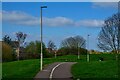
The lifestyle in GL4 7YZ is shaped by its proximity to essential amenities. Five retail outlets, including Morrisons Gloucester, M&S Barnwood BP, and Farmfoods Coney, provide convenient shopping options for daily needs. The two railway stations, Gloucester and Cheltenham Spa, offer easy access to nearby urban centres, while three airports, all Gloucestershire Airport, may cater to those requiring regular travel. Though the data does not specify parks or leisure facilities, the presence of multiple retail and transport hubs suggests a practical, service-oriented lifestyle. The area’s small size means residents are close to these amenities, reducing the need for long commutes. However, the absence of detailed information on recreational spaces or cultural venues leaves gaps in understanding the full range of lifestyle options available. For those prioritising convenience and connectivity, GL4 7YZ offers a functional, if unremarkable, array of amenities.
Amenities
Schools
Residents of GL4 7YZ have access to two notable educational institutions. The Barnwood Church of England Primary School, a primary school with a ‘good’ Ofsted rating, serves younger children, offering a solid foundation for early education. The Eastbrook Education Trust, categorised as ‘other’, adds diversity to the local school options, though its specific focus or age range is not detailed. The presence of a primary school with a strong rating is a significant draw for families, ensuring proximity to quality early education. While no secondary schools are listed, the combination of a primary school and additional educational providers suggests a range of opportunities for children of different ages. For parents, the availability of a ‘good’-rated primary school may be a key factor in deciding to settle in the area, though further research would be needed to confirm the full scope of educational provision.
| Rank | School | Type | Entry gender | Ages |
|---|---|---|---|---|
| 1 | Barnwood Church of England Primary School | primary | N/A | N/A |
| 2 | Eastbrook Education Trust | other | N/A | N/A |
Explore more schools in this area
Go to Schools tabDemographics
The demographic profile of GL4 7YZ is defined by a median age of 47, with the majority of residents falling within the 30–64 age range. This suggests a community skewed towards middle-aged adults, likely including families with children. Home ownership is high at 71%, indicating a stable population with long-term residency. The accommodation type is predominantly houses, which aligns with the age profile of older, established households. The predominant ethnic group is White, though no further breakdown of diversity is provided. The absence of specific data on deprivation means the quality of life cannot be fully assessed, but the high home ownership rate and family-centric age range imply a focus on comfort and stability. The area’s compact nature may contribute to a close-knit social environment, though the lack of detailed diversity metrics limits a fuller understanding of its cultural makeup.
Household Size
Accommodation Type
Tenure
Ethnic Group
Religion
Household Composition
Age
Household Deprivation
NS-SEC
Explore more demographic insights in this area
Go to Demographics tabPlanning
Planning Constraints
- Flood RiskPremium
- Ramsar Wetland SitesPremium
- Area of Outstanding Natural BeautyPremium
- Protected Nature ReservePremium
- Protected WoodlandPremium
- Crime RiskPremium