Area Overview for GL4 7DW
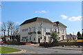
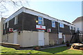
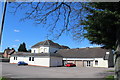
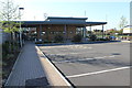
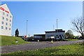
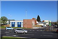
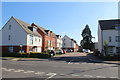
Photos of GL4 7DW

Area Information
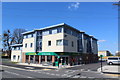
Living in GL4 7DW offers a compact, residential experience shaped by its small cluster of homes and proximity to key services. With a population of 1,957 spread across 1.73 km², the area is densely populated yet retains a quiet, community-focused character. The median age of 47 suggests a stable demographic, with the majority of residents aged 30–64. This is a place where homeownership is prevalent—71% of households own their homes—indicating long-term residency and a focus on family living. The area’s proximity to Barnwood Church of England Primary School and nearby rail links to Gloucester and Cheltenham adds practicality for daily life. While the population density is high, the presence of retail hubs like M&S Barnwood BP and Morrisons Gloucester ensures convenience. For commuters, the area’s rail connections and three nearby airports, including Gloucestershire Airport, provide flexibility. GL4 7DW is a small but well-connected postcode, balancing residential tranquillity with access to essential amenities.
- Area Type
- Postcode
- Area Size
- Not available
- Population
- 1957
- Population Density
- 1132 people/km²
The property market in GL4 7DW is characterised by a strong emphasis on owner-occupied homes, with 71% of residents living in properties they own. This suggests a stable, long-term housing stock rather than a rental-heavy market. The predominant accommodation type is houses, which aligns with the area’s residential focus and likely contributes to a quieter, family-oriented environment. Given the small size of the postcode, the housing options are limited to this specific cluster, meaning buyers should consider the immediate surroundings for additional choices. The high home ownership rate may indicate lower turnover, which could be appealing to those seeking a settled community. However, the compact nature of the area means property availability is constrained, requiring buyers to explore nearby postcodes for broader options.
House Prices in GL4 7DW
No properties found in this postcode.
Energy Efficiency in GL4 7DW
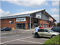
The lifestyle in GL4 7DW is shaped by its proximity to a range of amenities, including five retail venues such as M&S Barnwood BP, Morrisons Gloucester, and Co-op Barnwood. These provide convenience for daily shopping and dining. The area’s rail links to Gloucester and Cheltenham Spa make commuting practical, while the three nearby airports, including Gloucestershire Airport, offer travel flexibility. Though the area is small, the combination of retail, transport, and nearby natural spaces—while not explicitly named—suggests a balance between urban convenience and accessible green spaces. The presence of these amenities supports a practical, community-focused lifestyle, with options for both routine errands and broader travel needs.
Amenities
Schools
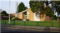
Residents of GL4 7DW have access to Barnwood Church of England Primary School, which holds an Ofsted rating of 'good'. This provides a reliable option for younger children, though the area lacks secondary schools. The nearby Eastbrook Education Trust, listed as an 'other' type of institution, may offer additional educational or specialist services. The mix of school types suggests that while primary education is well-supported, families may need to look further afield for secondary schooling. This could be a consideration for parents prioritising a full range of educational options. However, the presence of a 'good' primary school is a positive factor for those valuing strong early education within the area.
| Rank | School | Type | Entry gender | Ages |
|---|
Explore more schools in this area
Go to Schools tabDemographics
The community in GL4 7DW is predominantly composed of adults aged 30–64, with a median age of 47. This suggests a mature population, likely with established careers and family ties to the area. Homeownership is strong, with 71% of residents living in their own homes, indicating a stable, long-term demographic. The accommodation type is primarily houses, reflecting a residential area with fewer flats or apartments. The predominant ethnic group is White, and no data indicates significant diversity beyond this. The population density of 1,132 people per km² highlights a compact living environment, which may influence local social dynamics. While no specific deprivation data is provided, the high home ownership rate and presence of essential amenities suggest a quality of life that supports both practical needs and community cohesion.
Household Size
Accommodation Type
Tenure
Ethnic Group
Religion
Household Composition
Age
Household Deprivation
NS-SEC
Explore more demographic insights in this area
Go to Demographics tabPlanning
Planning Constraints
- Flood RiskPremium
- Ramsar Wetland SitesPremium
- Area of Outstanding Natural BeautyPremium
- Protected Nature ReservePremium
- Protected WoodlandPremium