Area Overview for GL4 4BH
Photos of GL4 4BH
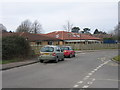


26 photos from this area
Area Information
Key information about the GL4 4BH including its size, population, and administrative classification.
- Area Type
- Postcode
- Area Size
- 6258 m²
- Population
- 1444
- Population Density
- 3557 people/km²
House Prices in GL4 4BH
18
Properties
£135,178
Average Sold Price
£67,950
Lowest Price
£190,000
Highest Price
Showing 18 properties
| Address | Type | Beds | Baths | Last Sale Price | Last Sale Date | |
|---|---|---|---|---|---|---|
| 13, Abbeydale Court, Heron Way, Gloucester, GL4 4BH | Flat | - | - | £175,000 | Feb 2025 | |
| 18, Abbeydale Court, Heron Way, Gloucester, GL4 4BH | Maisonette | 2 | 1 | £180,000 | Jul 2023 | |
| 6, Abbeydale Court, Heron Way, Gloucester, GL4 4BH | Flat | 2 | 1 | £190,000 | Oct 2022 | |
| 2, Abbeydale Court, Heron Way, Gloucester, GL4 4BH | Flat | 2 | 1 | £175,000 | May 2022 | |
| 3, Abbeydale Court, Heron Way, Gloucester, GL4 4BH | Flat | 2 | 1 | £150,000 | Dec 2018 | |
| 15, Abbeydale Court, Heron Way, Gloucester, GL4 4BH | Flat | - | - | £155,000 | May 2018 | |
| 12, Abbeydale Court, Heron Way, Gloucester, GL4 4BH | Maisonette | - | - | £170,000 | Sep 2017 | |
| 8, Abbeydale Court, Heron Way, Gloucester, GL4 4BH | Maisonette | - | - | £150,000 | Sep 2016 | |
| 7, Abbeydale Court, Heron Way, Gloucester, GL4 4BH | Maisonette | - | - | £139,750 | Oct 2015 | |
| 14, Abbeydale Court, Heron Way, Gloucester, GL4 4BH | Maisonette | 2 | 1 | £117,000 | Jun 2015 |
Page 1 of 2
Energy Efficiency in GL4 4BH
Amenities
Schools
| Rank | School | Type | Entry gender | Ages |
|---|
Explore more schools in this area
Go to Schools tabDemographics
Household Size
Two person
most common
Accommodation Type
Houses
most common
Tenure
85
majority
Ethnic Group
White
most common
Religion
N/A
most common
Household Composition
N/A
most common
Age
47
median
Adults (30-64 years)
most common
Household Deprivation
N/A
with no deprivation
NS-SEC
34
in Lower managerial occupations
Explore more demographic insights in this area
Go to Demographics tabPlanning
Planning Constraints
- Flood RiskPremium
- Ramsar Wetland SitesPremium
- Area of Outstanding Natural BeautyPremium
- Protected Nature ReservePremium
- Protected WoodlandPremium