Area Overview for GL4 3QT
Photos of GL4 3QT
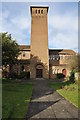
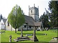
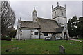
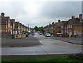
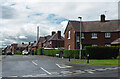
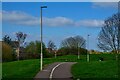
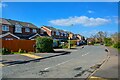

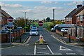
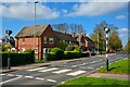
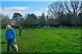
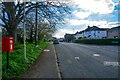
38 photos from this area
Area Information
Key information about the GL4 3QT including its size, population, and administrative classification.
- Area Type
- Postcode
- Area Size
- 7097 m²
- Population
- 1407
- Population Density
- 3997 people/km²
House Prices in GL4 3QT
11
Properties
£151,750
Average Sold Price
£72,000
Lowest Price
£205,000
Highest Price
Showing 11 properties
| Address | Type | Beds | Baths | Last Sale Price | Last Sale Date | |
|---|---|---|---|---|---|---|
| 65A St Lawrence Road, Gloucester, GL4 3QT | Detached | 3 | 1 | £205,000 | May 2020 | |
| 79 St Lawrence Road, Gloucester, GL4 3QT | Terraced | 3 | 1 | £195,000 | Dec 2018 | |
| 65 St Lawrence Road, Gloucester, GL4 3QT | Semi-detached | 3 | 1 | £190,000 | Oct 2017 | |
| 71 St Lawrence Road, Gloucester, GL4 3QT | house | - | - | £170,000 | Nov 2009 | |
| 67 St Lawrence Road, Gloucester, GL4 3QT | Terraced | - | - | £72,000 | Dec 2001 | |
| 81 St Lawrence Road, Gloucester, GL4 3QT | Semi-detached | - | - | £78,500 | Jul 2000 | |
| 69 St Lawrence Road, Gloucester, GL4 3QT | house | - | - | - | - | |
| 77 St Lawrence Road, Gloucester, GL4 3QT | house | - | - | - | - | |
| 83 St Lawrence Road, Gloucester, GL4 3QT | house | - | - | - | - | |
| 75 St Lawrence Road, Gloucester, GL4 3QT | Semi-detached | - | - | - | - |
Page 1 of 2
Energy Efficiency in GL4 3QT
Amenities
Schools
| Rank | School | Type | Entry gender | Ages |
|---|
Explore more schools in this area
Go to Schools tabDemographics
Household Size
Family (3-5 people)
most common
Accommodation Type
Houses
most common
Tenure
60
majority
Ethnic Group
White
most common
Religion
N/A
most common
Household Composition
N/A
most common
Age
47
median
Adults (30-64 years)
most common
Household Deprivation
N/A
with no deprivation
NS-SEC
23
in Lower managerial occupations
Explore more demographic insights in this area
Go to Demographics tabPlanning
Planning Constraints
- Flood RiskPremium
- Ramsar Wetland SitesPremium
- Area of Outstanding Natural BeautyPremium
- Protected Nature ReservePremium
- Protected WoodlandPremium