Area Overview for GL4 0YS
Photos of GL4 0YS


Area Information
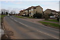
Living in GL4 0YS offers a quiet, residential experience with a small cluster of homes catering to a close-knit community. With a population of 1,523, this area is characterised by its low-density housing, predominantly single-family homes. The median age of 47 suggests a stable demographic, with most residents falling within the 30-64 age range. This makes GL4 0YS a place where families and long-term residents coexist, creating a familiar, settled environment. The area’s proximity to Gloucester and surrounding towns provides easy access to urban amenities without the congestion of larger cities. Daily life here is shaped by local shops, rail links, and a low crime risk, offering a balance of convenience and tranquillity. While the area lacks major landmarks or cultural hubs, its simplicity and safety appeal to those seeking a relaxed lifestyle. For buyers, GL4 0YS represents a niche opportunity in a market where 83% of properties are owner-occupied, reflecting a community that values stability and permanence.
- Area Type
- Postcode
- Area Size
- Not available
- Population
- 1523
- Population Density
- 4234 people/km²
The property market in GL4 0YS is defined by its high home ownership rate of 83%, with the majority of homes being single-family houses. This suggests a market where long-term residents predominate, and rental properties are relatively scarce. The small population and limited area mean the housing stock is finite, with little scope for new developments. For buyers, this creates a niche market where properties are likely to remain in private hands rather than being sold to investors. The predominance of houses over flats or apartments also means the area may not appeal to those seeking more affordable or flexible living arrangements. However, for those prioritising stability and a low-crime environment, GL4 0YS offers a secure investment. The limited size of the area means buyers should consider nearby towns like Gloucester or Stroud for broader property options.
House Prices in GL4 0YS
No properties found in this postcode.
Energy Efficiency in GL4 0YS
Residents of GL4 0YS have access to a range of amenities within practical reach. The retail sector includes major supermarkets like Tesco Gloucester, Morrisons Daily, and Asda Tuffley, ensuring everyday shopping needs are met locally. Three rail stations—Gloucester, Stonehouse, and Stroud—offer convenient transport links to nearby towns and cities, enhancing mobility. The presence of Gloucestershire Airport, though listed three times, suggests proximity to regional travel options. While the data does not specify parks or leisure facilities, the rail and retail infrastructure indicates a functional lifestyle. The area’s small size means amenities are compact, but the combination of shops, transport, and digital connectivity supports a self-contained daily life. For those who prioritise convenience over extensive leisure options, GL4 0YS provides a straightforward, practical environment.
Amenities
Schools
Residents of GL4 0YS have access to two primary schools: Grange Primary School and Grange Primary Academy. Both institutions serve the local community, though Grange Primary Academy holds an Ofsted rating of ‘satisfactory’. This mix of schools provides families with options, though the rating suggests there may be room for improvement in educational standards. The presence of two primary schools within the area is a practical advantage, reducing the need for long commutes for younger children. However, no secondary schools are listed in the data, meaning students may need to travel to nearby towns for higher education. The limited number of schools also means competition for places could be a concern, particularly during peak enrollment periods. For families prioritising proximity to education, GL4 0YS offers a starting point, but further research into secondary schooling options is advisable.
| Rank | School | Type | Entry gender | Ages |
|---|
Explore more schools in this area
Go to Schools tabDemographics
The community in GL4 0YS is predominantly composed of adults aged 30-64, with a median age of 47. This suggests a population largely in their prime working years, many of whom are likely to be homeowners. With 83% of homes owned outright, the area leans heavily towards owner-occupation rather than rental properties. The accommodation types are primarily houses, indicating a lack of high-density housing or apartments. The predominant ethnic group is White, though no specific diversity statistics are provided. The low population—just 1,523 people—means the area is small enough to foster a sense of familiarity among residents. However, this also limits the range of local services and social interactions. The absence of detailed deprivation data means it is unclear whether the area faces socioeconomic challenges, but the high home ownership rate and low crime risk suggest a relatively stable, middle-income community.
Household Size
Accommodation Type
Tenure
Ethnic Group
Religion
Household Composition
Age
Household Deprivation
NS-SEC
Explore more demographic insights in this area
Go to Demographics tabPlanning
Planning Constraints
- Flood RiskPremium
- Ramsar Wetland SitesPremium
- Area of Outstanding Natural BeautyPremium
- Protected Nature ReservePremium
- Protected WoodlandPremium