Area Overview for GL4 0HW
Photos of GL4 0HW


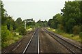
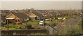
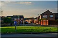
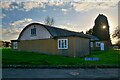


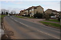


19 photos from this area
Area Information
Key information about the GL4 0HW including its size, population, and administrative classification.
- Area Type
- Postcode
- Area Size
- 6784 m²
- Population
- 1518
- Population Density
- 6789 people/km²
House Prices in GL4 0HW
22
Properties
£155,346
Average Sold Price
£41,000
Lowest Price
£245,000
Highest Price
Showing 22 properties
| Address | Type | Beds | Baths | Last Sale Price | Last Sale Date | |
|---|---|---|---|---|---|---|
| 42 Whittle Avenue, Gloucester, GL4 0HW | Semi-detached | 3 | 1 | £237,000 | Dec 2023 | |
| 6 Whittle Avenue, Gloucester, GL4 0HW | Retail | 2 | 1 | £200,000 | Jul 2022 | |
| 38 Whittle Avenue, Gloucester, GL4 0HW | Terraced | 3 | 1 | £245,000 | Sep 2021 | |
| 40 Whittle Avenue, Gloucester, GL4 0HW | house | 3 | 1 | £237,000 | Aug 2021 | |
| 52 Whittle Avenue, Gloucester, GL4 0HW | house | - | - | £225,000 | Jan 2021 | |
| 8 Whittle Avenue, Gloucester, GL4 0HW | house | 3 | - | £143,000 | Sep 2011 | |
| 2 Whittle Avenue, Gloucester, GL4 0HW | house | 3 | 2 | £145,000 | Aug 2010 | |
| 46 Whittle Avenue, Gloucester, GL4 0HW | house | - | - | £140,000 | Nov 2009 | |
| 56 Whittle Avenue, Gloucester, GL4 0HW | Semi-detached | - | - | £134,950 | Jun 2006 | |
| 50 Whittle Avenue, Gloucester, GL4 0HW | Semi-detached | - | - | £129,950 | Sep 2004 |
Page 1 of 3
Energy Efficiency in GL4 0HW
Amenities
Schools
| Rank | School | Type | Entry gender | Ages |
|---|
Explore more schools in this area
Go to Schools tabDemographics
Household Size
Two person
most common
Accommodation Type
Houses
most common
Tenure
37
majority
Ethnic Group
White
most common
Religion
N/A
most common
Household Composition
N/A
most common
Age
47
median
Adults (30-64 years)
most common
Household Deprivation
N/A
with no deprivation
NS-SEC
17
in Lower managerial occupations
Explore more demographic insights in this area
Go to Demographics tabPlanning
Planning Constraints
- Flood RiskPremium
- Ramsar Wetland SitesPremium
- Area of Outstanding Natural BeautyPremium
- Protected Nature ReservePremium
- Protected WoodlandPremium