Area Overview for GL3 4ZB
Photos of GL3 4ZB
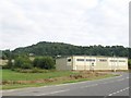
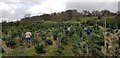
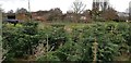
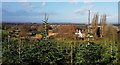
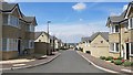
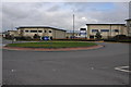
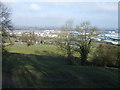
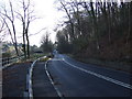
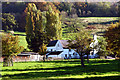
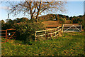
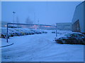
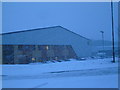
15 photos from this area
Area Information
Key information about the GL3 4ZB including its size, population, and administrative classification.
- Area Type
- Postcode
- Area Size
- 5178 m²
- Population
- 1356
- Population Density
- 3213 people/km²
House Prices in GL3 4ZB
15
Properties
£251,056
Average Sold Price
£166,245
Lowest Price
£347,500
Highest Price
Showing 15 properties
| Address | Type | Beds | Baths | Last Sale Price | Last Sale Date | |
|---|---|---|---|---|---|---|
| 12 Avocet Drive, Brockworth, Gloucester, GL3 4ZB | house | - | - | £347,500 | Jun 2023 | |
| 10 Avocet Drive, Brockworth, Gloucester, GL3 4ZB | Semi-detached | 3 | 2 | £315,000 | Feb 2022 | |
| 7 Avocet Drive, Brockworth, Gloucester, GL3 4ZB | Semi-detached | 2 | 1 | £208,500 | Mar 2020 | |
| 8 Avocet Drive, Brockworth, Gloucester, GL3 4ZB | Detached | 3 | 2 | £249,995 | Dec 2019 | |
| 4 Avocet Drive, Brockworth, Gloucester, GL3 4ZB | Detached | 2 | 1 | £179,995 | Dec 2019 | |
| 6 Avocet Drive, Brockworth, Gloucester, GL3 4ZB | Terraced | 3 | 2 | £249,995 | Dec 2019 | |
| 15 Avocet Drive, Brockworth, Gloucester, GL3 4ZB | house | - | - | £292,000 | Nov 2017 | |
| 14 Avocet Drive, Brockworth, Gloucester, GL3 4ZB | house | - | - | £292,000 | Nov 2017 | |
| 13 Avocet Drive, Brockworth, Gloucester, GL3 4ZB | house | - | - | £275,000 | Sep 2017 | |
| 9 Avocet Drive, Brockworth, Gloucester, GL3 4ZB | house | - | - | £240,000 | Jun 2017 |
Page 1 of 2
Energy Efficiency in GL3 4ZB
Amenities
Schools
| Rank | School | Type | Entry gender | Ages |
|---|
Explore more schools in this area
Go to Schools tabDemographics
Household Size
Family (3-5 people)
most common
Accommodation Type
Houses
most common
Tenure
71
majority
Ethnic Group
White
most common
Religion
N/A
most common
Household Composition
N/A
most common
Age
47
median
Adults (30-64 years)
most common
Household Deprivation
N/A
with no deprivation
NS-SEC
48
in Lower managerial occupations
Explore more demographic insights in this area
Go to Demographics tabPlanning
Planning Constraints
- Flood RiskPremium
- Ramsar Wetland SitesPremium
- Area of Outstanding Natural BeautyPremium
- Protected Nature ReservePremium
- Protected WoodlandPremium