Area Overview for GL3 4PP
Photos of GL3 4PP
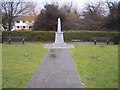
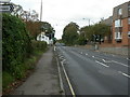
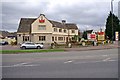
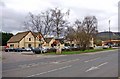
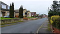
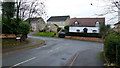
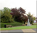
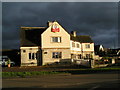
19 photos from this area
Area Information
Key information about the GL3 4PP including its size, population, and administrative classification.
- Area Type
- Postcode
- Area Size
- 1.4 hectares
- Population
- 2061
- Population Density
- 585 people/km²
House Prices in GL3 4PP
33
Properties
£163,119
Average Sold Price
£15,500
Lowest Price
£365,000
Highest Price
Showing 33 properties
| Address | Type | Beds | Baths | Last Sale Price | Last Sale Date | |
|---|---|---|---|---|---|---|
| 12 Wye Road, Brockworth, Gloucester, GL3 4PP | Detached | 3 | 1 | £182,500 | Sep 2024 | |
| 23 Wye Road, Brockworth, Gloucester, GL3 4PP | Semi-detached | 3 | 1 | £365,000 | Aug 2022 | |
| 20 Wye Road, Brockworth, Gloucester, GL3 4PP | Semi-detached | 3 | - | £287,500 | Feb 2021 | |
| 24 Wye Road, Brockworth, Gloucester, GL3 4PP | Detached | - | - | £225,000 | Jul 2018 | |
| 27 Wye Road, Brockworth, Gloucester, GL3 4PP | Detached | 4 | 1 | £300,000 | May 2017 | |
| 2 Wye Road, Brockworth, Gloucester, GL3 4PP | Semi-detached | 3 | 1 | £122,500 | Sep 2015 | |
| 17 Wye Road, Brockworth, Gloucester, GL3 4PP | Semi-detached | 3 | 1 | £105,000 | Jul 2015 | |
| 18 Wye Road, Brockworth, Gloucester, GL3 4PP | house | - | - | £170,000 | Jun 2009 | |
| 28 Wye Road, Brockworth, Gloucester, GL3 4PP | house | - | - | £165,000 | Aug 2006 | |
| 16 Wye Road, Brockworth, Gloucester, GL3 4PP | Semi-detached | - | - | £167,000 | Aug 2005 |
Page 1 of 4
Energy Efficiency in GL3 4PP
Amenities
Schools
| Rank | School | Type | Entry gender | Ages |
|---|
Explore more schools in this area
Go to Schools tabDemographics
Household Size
Two person
most common
Accommodation Type
Houses
most common
Tenure
84
majority
Ethnic Group
White
most common
Religion
N/A
most common
Household Composition
N/A
most common
Age
47
median
Adults (30-64 years)
most common
Household Deprivation
N/A
with no deprivation
NS-SEC
45
in Lower managerial occupations
Explore more demographic insights in this area
Go to Demographics tabPlanning
Planning Constraints
- Flood RiskPremium
- Ramsar Wetland SitesPremium
- Area of Outstanding Natural BeautyPremium
- Protected Nature ReservePremium
- Protected WoodlandPremium