Area Overview for GL3 4NB
Photos of GL3 4NB
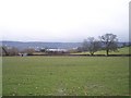
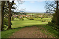
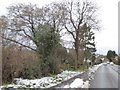
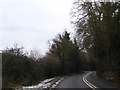
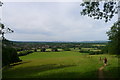
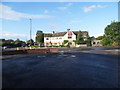

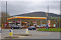

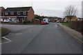
17 photos from this area
Area Information
Key information about the GL3 4NB including its size, population, and administrative classification.
- Area Type
- Postcode
- Area Size
- 1.7 hectares
- Population
- 1720
- Population Density
- 5476 people/km²
House Prices in GL3 4NB
55
Properties
£182,767
Average Sold Price
£103,000
Lowest Price
£320,000
Highest Price
Showing 55 properties
| Address | Type | Beds | Baths | Last Sale Price | Last Sale Date | |
|---|---|---|---|---|---|---|
| 32 Green Bank, Brockworth, Gloucester, GL3 4NB | Semi-detached | 3 | 1 | £145,000 | Mar 2024 | |
| 98 Green Bank, Brockworth, Gloucester, GL3 4NB | house | - | - | £267,500 | Jun 2023 | |
| 52 Green Bank, Brockworth, Gloucester, GL3 4NB | Semi-detached | 3 | - | £215,000 | Feb 2022 | |
| 104 Green Bank, Brockworth, Gloucester, GL3 4NB | house | - | - | £320,000 | Jan 2022 | |
| 66 Green Bank, Brockworth, Gloucester, GL3 4NB | house | - | - | £200,000 | Sep 2021 | |
| 86 Green Bank, Brockworth, Gloucester, GL3 4NB | house | 4 | - | £291,000 | Jun 2021 | |
| 102 Green Bank, Brockworth, Gloucester, GL3 4NB | Semi-detached | 4 | 2 | £243,000 | Apr 2020 | |
| 80 Green Bank, Brockworth, Gloucester, GL3 4NB | Semi-detached | 4 | - | £186,905 | Mar 2016 | |
| 106 Green Bank, Brockworth, Gloucester, GL3 4NB | Semi-detached | 4 | - | £190,000 | Aug 2014 | |
| 108 Green Bank, Brockworth, Gloucester, GL3 4NB | house | - | - | £189,950 | Jul 2010 |
Page 1 of 6
Energy Efficiency in GL3 4NB
Amenities
Schools
| Rank | School | Type | Entry gender | Ages |
|---|
Explore more schools in this area
Go to Schools tabDemographics
Household Size
Two person
most common
Accommodation Type
Houses
most common
Tenure
55
majority
Ethnic Group
White
most common
Religion
N/A
most common
Household Composition
N/A
most common
Age
47
median
Adults (30-64 years)
most common
Household Deprivation
N/A
with no deprivation
NS-SEC
28
in Lower managerial occupations
Explore more demographic insights in this area
Go to Demographics tabPlanning
Planning Constraints
- Flood RiskPremium
- Ramsar Wetland SitesPremium
- Area of Outstanding Natural BeautyPremium
- Protected Nature ReservePremium
- Protected WoodlandPremium