Area Overview for GL3 2ET
Photos of GL3 2ET


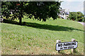
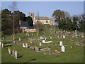
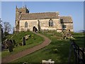
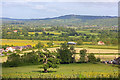


72 photos from this area
Area Information
Key information about the GL3 2ET including its size, population, and administrative classification.
- Area Type
- Postcode
- Area Size
- 2.0 hectares
- Population
- 1415
- Population Density
- 394 people/km²
House Prices in GL3 2ET
26
Properties
£317,294
Average Sold Price
£215,000
Lowest Price
£490,000
Highest Price
Showing 26 properties
| Address | Type | Beds | Baths | Last Sale Price | Last Sale Date | |
|---|---|---|---|---|---|---|
| 7 Chapel Hay Lane, Churchdown, Gloucester, GL3 2ET | Bungalow | 4 | - | £416,500 | Jul 2022 | |
| 10 Chapel Hay Lane, Churchdown, Gloucester, GL3 2ET | house | - | - | £315,000 | Mar 2021 | |
| 34 Chapel Hay Lane, Churchdown, Gloucester, GL3 2ET | Bungalow | - | - | £425,000 | Jan 2021 | |
| 11 Chapel Hay Lane, Churchdown, Gloucester, GL3 2ET | Semi-detached | 4 | 2 | £400,000 | Jan 2020 | |
| 30 Chapel Hay Lane, Churchdown, Gloucester, GL3 2ET | Bungalow | 3 | 2 | £350,000 | Jul 2018 | |
| 36 Chapel Hay Lane, Churchdown, Gloucester, GL3 2ET | Bungalow | 3 | 2 | £367,300 | Oct 2016 | |
| 22 Chapel Hay Lane, Churchdown, Gloucester, GL3 2ET | Semi-detached | 3 | - | £290,000 | Sep 2016 | |
| 18 Chapel Hay Lane, Churchdown, Gloucester, GL3 2ET | Semi-detached | - | - | £275,000 | Nov 2013 | |
| 8 Chapel Hay Lane, Churchdown, Gloucester, GL3 2ET | Semi-detached | 3 | - | £332,500 | Sep 2013 | |
| 19 Chapel Hay Lane, Churchdown, Gloucester, GL3 2ET | house | - | - | £215,000 | Dec 2012 |
Page 1 of 3
Energy Efficiency in GL3 2ET
Amenities
Schools
| Rank | School | Type | Entry gender | Ages |
|---|
Explore more schools in this area
Go to Schools tabDemographics
Household Size
Two person
most common
Accommodation Type
Houses
most common
Tenure
93
majority
Ethnic Group
White
most common
Religion
N/A
most common
Household Composition
N/A
most common
Age
47
median
Adults (30-64 years)
most common
Household Deprivation
N/A
with no deprivation
NS-SEC
48
in Lower managerial occupations
Explore more demographic insights in this area
Go to Demographics tabPlanning
Planning Constraints
- Flood RiskPremium
- Ramsar Wetland SitesPremium
- Area of Outstanding Natural BeautyPremium
- Protected Nature ReservePremium
- Protected WoodlandPremium