Area Overview for GL20 8QJ
Photos of GL20 8QJ


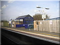


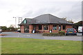

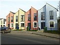
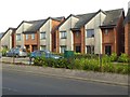
100 photos from this area
Area Information
Key information about the GL20 8QJ including its size, population, and administrative classification.
- Area Type
- Postcode
- Area Size
- 6319 m²
- Population
- 1313
- Population Density
- 2394 people/km²
House Prices in GL20 8QJ
20
Properties
£131,667
Average Sold Price
£42,500
Lowest Price
£240,000
Highest Price
Showing 20 properties
| Address | Type | Beds | Baths | Last Sale Price | Last Sale Date | |
|---|---|---|---|---|---|---|
| 54 Kingston Road, Northway, Tewkesbury, GL20 8QJ | Terraced | 3 | 1 | £235,000 | Jul 2024 | |
| 56 Kingston Road, Northway, Tewkesbury, GL20 8QJ | house | - | - | £240,000 | Jun 2022 | |
| 40 Kingston Road, Northway, Tewkesbury, GL20 8QJ | Terraced | 3 | 1 | £210,000 | Sep 2021 | |
| 26 Kingston Road, Northway, Tewkesbury, GL20 8QJ | Terraced | 3 | 1 | £190,000 | Apr 2019 | |
| 50 Kingston Road, Northway, Tewkesbury, GL20 8QJ | house | 3 | - | £150,000 | Aug 2012 | |
| 42 Kingston Road, Northway, Tewkesbury, GL20 8QJ | house | - | - | £130,000 | Apr 2010 | |
| 22 Kingston Road, Northway, Tewkesbury, GL20 8QJ | Terraced | - | - | £127,000 | Apr 2009 | |
| 20 Kingston Road, Northway, Tewkesbury, GL20 8QJ | Terraced | 4 | 1 | £76,500 | Nov 2001 | |
| 52 Kingston Road, Northway, Tewkesbury, GL20 8QJ | Detached | 3 | 1 | £74,000 | Nov 2000 | |
| 32 Kingston Road, Northway, Tewkesbury, GL20 8QJ | Terraced | - | - | £52,500 | Apr 1997 |
Page 1 of 2
Energy Efficiency in GL20 8QJ
Amenities
Schools
| Rank | School | Type | Entry gender | Ages |
|---|
Explore more schools in this area
Go to Schools tabDemographics
Household Size
Family (3-5 people)
most common
Accommodation Type
Houses
most common
Tenure
87
majority
Ethnic Group
White
most common
Religion
N/A
most common
Household Composition
N/A
most common
Age
47
median
Adults (30-64 years)
most common
Household Deprivation
N/A
with no deprivation
NS-SEC
27
in Lower managerial occupations
Explore more demographic insights in this area
Go to Demographics tabPlanning
Planning Constraints
- Flood RiskPremium
- Ramsar Wetland SitesPremium
- Area of Outstanding Natural BeautyPremium
- Protected Nature ReservePremium
- Protected WoodlandPremium