Area Overview for GL20 6JN
Photos of GL20 6JN
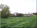
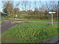
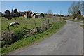


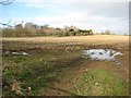
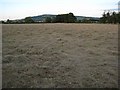
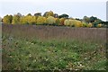
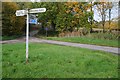
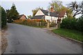
101 photos from this area
Area Information
Key information about the GL20 6JN including its size, population, and administrative classification.
- Area Type
- Postcode
- Area Size
- 4.4 hectares
- Population
- 1939
- Population Density
- 130 people/km²
House Prices in GL20 6JN
44
Properties
£209,940
Average Sold Price
£59,000
Lowest Price
£415,000
Highest Price
Showing 44 properties
| Address | Type | Beds | Baths | Last Sale Price | Last Sale Date | |
|---|---|---|---|---|---|---|
| 79 Hillview Lane, Twyning, Tewkesbury, GL20 6JN | Bungalow | 3 | 2 | £415,000 | Aug 2024 | |
| 52 Hillview Lane, Twyning, Tewkesbury, GL20 6JN | Semi-detached | 4 | 1 | £312,500 | Mar 2024 | |
| 53 Hillview Lane, Twyning, Tewkesbury, GL20 6JN | Semi-detached | 4 | 2 | £350,000 | Oct 2023 | |
| 49 Hillview Lane, Twyning, Tewkesbury, GL20 6JN | Semi-detached | 3 | 2 | £335,000 | Apr 2023 | |
| 59 Hillview Lane, Twyning, Tewkesbury, GL20 6JN | house | - | - | £300,000 | Nov 2021 | |
| 73 Hillview Lane, Twyning, Tewkesbury, GL20 6JN | Bungalow | 3 | 1 | £385,000 | Aug 2021 | |
| 34 Hillview Lane, Twyning, Tewkesbury, GL20 6JN | Bungalow | 3 | 1 | £265,000 | Mar 2021 | |
| 37 Hillview Lane, Twyning, Tewkesbury, GL20 6JN | Bungalow | - | - | £247,280 | Oct 2020 | |
| 50 Hillview Lane, Twyning, Tewkesbury, GL20 6JN | Bungalow | 3 | 2 | £249,950 | Jul 2019 | |
| 45 Hillview Lane, Twyning, Tewkesbury, GL20 6JN | Bungalow | 2 | 1 | £216,000 | Jun 2019 |
Page 1 of 5
Energy Efficiency in GL20 6JN
Amenities
Schools
| Rank | School | Type | Entry gender | Ages |
|---|
Explore more schools in this area
Go to Schools tabDemographics
Household Size
Two person
most common
Accommodation Type
Houses
most common
Tenure
88
majority
Ethnic Group
White
most common
Religion
N/A
most common
Household Composition
N/A
most common
Age
47
median
Adults (30-64 years)
most common
Household Deprivation
N/A
with no deprivation
NS-SEC
43
in Lower managerial occupations
Explore more demographic insights in this area
Go to Demographics tabPlanning
Planning Constraints
- Flood RiskPremium
- Ramsar Wetland SitesPremium
- Area of Outstanding Natural BeautyPremium
- Protected Nature ReservePremium
- Protected WoodlandPremium