Area Overview for GL20 6FL
Photos of GL20 6FL


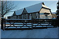


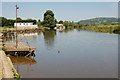
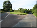
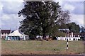
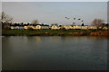
100 photos from this area
Area Information
Key information about the GL20 6FL including its size, population, and administrative classification.
- Area Type
- Postcode
- Area Size
- 2.6 hectares
- Population
- 1939
- Population Density
- 130 people/km²
House Prices in GL20 6FL
7
Properties
£523,250
Average Sold Price
£275,000
Lowest Price
£792,000
Highest Price
Showing 7 properties
| Address | Type | Beds | Baths | Last Sale Price | Last Sale Date | |
|---|---|---|---|---|---|---|
| Perins, Fleet Lane, Twyning, Tewkesbury, GL20 6FL | Detached | 5 | 5 | £792,000 | Dec 2025 | |
| Avon Cottage, Fleet Lane, Twyning, Tewkesbury, GL20 6FL | Detached | 5 | 3 | £740,000 | Jul 2023 | |
| Fleet Lane Cottage, Fleet Lane, Twyning, Tewkesbury, GL20 6FL | Detached | 4 | - | £441,000 | Oct 2014 | |
| Fleet House, Fleet Lane, Twyning, Tewkesbury, GL20 6FL | Detached | - | - | £605,000 | Sep 2005 | |
| The Moorings, Fleet Lane, Twyning, Tewkesbury, GL20 6FL | Detached | 4 | 3 | £286,500 | Feb 2000 | |
| Mullins, Fleet Lane, Twyning, Tewkesbury, GL20 6FL | Detached | 4 | 2 | £275,000 | Jan 1998 | |
| The Fleet Inn, Fleet Lane, Twyning, Tewkesbury, GL20 6FL | restaurant_cafe | - | - | - | - |
Energy Efficiency in GL20 6FL
Amenities
Schools
| Rank | School | Type | Entry gender | Ages |
|---|
Explore more schools in this area
Go to Schools tabDemographics
Household Size
Two person
most common
Accommodation Type
Houses
most common
Tenure
88
majority
Ethnic Group
White
most common
Religion
N/A
most common
Household Composition
N/A
most common
Age
47
median
Adults (30-64 years)
most common
Household Deprivation
N/A
with no deprivation
NS-SEC
43
in Lower managerial occupations
Explore more demographic insights in this area
Go to Demographics tabPlanning
Planning Constraints
- Flood RiskPremium
- Ramsar Wetland SitesPremium
- Area of Outstanding Natural BeautyPremium
- Protected Nature ReservePremium
- Protected WoodlandPremium