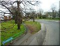
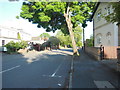
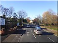
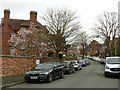
Area Overview for GL2 9JS
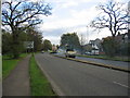
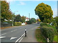
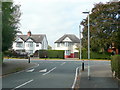
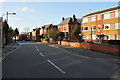
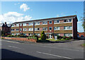
Photos of GL2 9JS


Area Information
Living in GL2 9JS offers a quiet, residential experience in a small cluster of homes. With a population of just 1,714, this postcode area is compact, fostering a close-knit community feel. The area’s demographics suggest a mature population, with a median age of 47 and most residents falling within the 30–64 age range. Home ownership is high at 93%, indicating a stable, long-term presence of residents. Daily life here is likely characterised by a balance between local amenities and easy access to nearby towns. The proximity to Gloucester and Cheltenham railway stations, along with three nearby airports, suggests connectivity to broader regional networks. While the area lacks major urban features, its low crime risk and absence of environmental constraints make it appealing for those prioritising safety and simplicity. The presence of The Hawthorns School, a special school, adds a layer of tailored education options for families. For buyers, GL2 9JS represents a niche market with a focus on owner-occupied housing, offering a peaceful alternative to larger towns.
- Area Type
- Postcode
- Area Size
- Not available
- Population
- 1714
- Population Density
- 3502 people/km²
The property market in GL2 9JS is dominated by owner-occupied homes, with 93% of residents owning their properties. This high rate of home ownership suggests a stable market with limited rental activity, making it a less common target for investors seeking rental income. The accommodation type is exclusively houses, which is unusual for areas with higher flat or apartment density. This likely reflects the area’s small size and rural or semi-rural setting, where larger properties are more feasible. For buyers, the market is niche, with limited options due to the postcode’s small footprint. The absence of planning constraints such as AONB or protected woodlands may make it easier to acquire property without regulatory hurdles. However, the lack of nearby commercial or industrial zones means property values are unlikely to be driven by speculative development.
House Prices in GL2 9JS
Showing 5 properties
| Address | Type | Beds | Baths | Last Sale Price | Last Sale Date | |
|---|---|---|---|---|---|---|
| 5 Damson Close, Twigworth, Gloucester, GL2 9JS | Detached | 4 | 3 | - | - | |
| 7 Damson Close, Twigworth, Gloucester, GL2 9JS | house | - | - | - | - | |
| 6 Damson Close, Twigworth, Gloucester, GL2 9JS | house | - | - | - | - | |
| 10 Damson Close, Twigworth, Gloucester, GL2 9JS | house | - | - | - | - | |
| 8 Damson Close, Twigworth, Gloucester, GL2 9JS | house | - | - | - | - |
Energy Efficiency in GL2 9JS
Daily life in GL2 9JS is supported by a range of nearby amenities. The area is within practical reach of five retail outlets, including Co-op Longlevens and Tesco Longlevens, ensuring access to essential shopping. For dining, while no specific restaurants are listed, the presence of multiple supermarkets suggests a variety of food options. The nearby railway stations provide connections to Gloucester and Cheltenham, offering access to cultural and leisure opportunities in larger towns. The three airports, though not named distinctly, may appeal to those requiring regular travel. However, the absence of parks, leisure centres, or recreational facilities in the immediate area means outdoor activities may require travel to nearby towns. The overall lifestyle is practical, with a focus on convenience and connectivity rather than extensive local amenities.
Amenities
Schools
The nearest school to GL2 9JS is The Hawthorns School, a special school catering to students with specific educational needs. This suggests the area may attract families seeking tailored support for children with learning differences or disabilities. While no other schools are listed in the data, the presence of a special school indicates a focus on inclusive education. For parents, this could be a significant factor, as it provides access to specialist resources without requiring long commutes. However, the absence of primary or secondary schools in the immediate vicinity means families may need to look further afield for broader educational options. The school’s Ofsted rating is not specified, but its existence implies a commitment to addressing diverse educational needs within the community.
| Rank | School | Type | Entry gender | Ages |
|---|
Explore more schools in this area
Go to Schools tabDemographics
The community in GL2 9JS is predominantly composed of adults aged 30–64, with a median age of 47. This suggests a population largely in their prime working years, potentially supporting local businesses and services. Home ownership is exceptionally high at 93%, indicating a stable, settled demographic with long-term residency. The area is characterised by houses rather than flats, reflecting a preference for single-family homes. The predominant ethnic group is White, which aligns with broader regional trends. The absence of specific data on deprivation or diversity means the area’s social fabric is not fully detailed, but the high home ownership rate and mature age profile imply a relatively affluent, low-turnover community. For families, this demographic structure may mean a quieter, less transient environment compared to areas with higher rental populations.
Household Size
Accommodation Type
Tenure
Ethnic Group
Religion
Household Composition
Age
Household Deprivation
NS-SEC
Explore more demographic insights in this area
Go to Demographics tabPlanning
Planning Constraints
- Flood RiskPremium
- Ramsar Wetland SitesPremium
- Area of Outstanding Natural BeautyPremium
- Protected Nature ReservePremium
- Protected WoodlandPremium