Area Overview for GL2 9FA
Photos of GL2 9FA

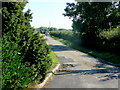
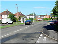
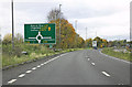


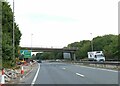
21 photos from this area
Area Information
Key information about the GL2 9FA including its size, population, and administrative classification.
- Area Type
- Postcode
- Area Size
- 8654 m²
- Population
- 2342
- Population Density
- 590 people/km²
House Prices in GL2 9FA
51
Properties
£257,088
Average Sold Price
£170,000
Lowest Price
£335,000
Highest Price
Showing 51 properties
| Address | Type | Beds | Baths | Last Sale Price | Last Sale Date | |
|---|---|---|---|---|---|---|
| 55 Winter Gate Road, Longford, Gloucester, GL2 9FA | Retail | 4 | 2 | £335,000 | Dec 2022 | |
| 51 Winter Gate Road, Longford, Gloucester, GL2 9FA | house | - | - | £275,000 | Aug 2022 | |
| 23 Winter Gate Road, Longford, Gloucester, GL2 9FA | Terraced | 4 | 3 | £302,000 | Feb 2022 | |
| 57 Winter Gate Road, Longford, Gloucester, GL2 9FA | Terraced | 4 | 3 | £300,000 | Jan 2022 | |
| 15 Winter Gate Road, Longford, Gloucester, GL2 9FA | Detached | 2 | - | £170,000 | Feb 2021 | |
| 61 Winter Gate Road, Longford, Gloucester, GL2 9FA | Semi-detached | 3 | 1 | £232,500 | Jun 2020 | |
| 19 Winter Gate Road, Longford, Gloucester, GL2 9FA | house | - | - | £250,000 | May 2019 | |
| 29 Winter Gate Road, Longford, Gloucester, GL2 9FA | Semi-detached | 4 | 3 | £270,000 | Feb 2018 | |
| 27 Winter Gate Road, Longford, Gloucester, GL2 9FA | Semi-detached | 4 | 3 | £265,000 | Feb 2018 | |
| 25 Winter Gate Road, Longford, Gloucester, GL2 9FA | Semi-detached | 4 | 3 | £265,000 | Feb 2018 |
Page 1 of 6
Energy Efficiency in GL2 9FA
Amenities
Schools
| Rank | School | Type | Entry gender | Ages |
|---|
Explore more schools in this area
Go to Schools tabDemographics
Household Size
Two person
most common
Accommodation Type
Houses
most common
Tenure
70
majority
Ethnic Group
White
most common
Religion
N/A
most common
Household Composition
N/A
most common
Age
47
median
Adults (30-64 years)
most common
Household Deprivation
N/A
with no deprivation
NS-SEC
36
in Lower managerial occupations
Explore more demographic insights in this area
Go to Demographics tabPlanning
Planning Constraints
- Flood RiskPremium
- Ramsar Wetland SitesPremium
- Area of Outstanding Natural BeautyPremium
- Protected Nature ReservePremium
- Protected WoodlandPremium