Area Overview for GL2 8AS
Photos of GL2 8AS
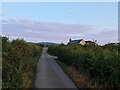
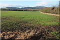
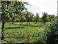
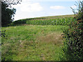
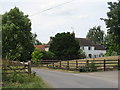


15 photos from this area
Area Information
Key information about the GL2 8AS including its size, population, and administrative classification.
- Area Type
- Postcode
- Area Size
- 1.1 km²
- Population
- 1804
- Population Density
- 96 people/km²
House Prices in GL2 8AS
39
Properties
£325,333
Average Sold Price
£70,000
Lowest Price
£625,000
Highest Price
Showing 39 properties
| Address | Type | Beds | Baths | Last Sale Price | Last Sale Date | |
|---|---|---|---|---|---|---|
| Evergreen, Bulley Lane, Churcham, GL2 8AS | Bungalow | 3 | 2 | £580,000 | Oct 2023 | |
| Marazan, Springdale, Birdwood, GL2 8AS | Bungalow | 3 | 1 | £300,000 | Sep 2021 | |
| Glendale, Springdale, Birdwood, GL2 8AS | Bungalow | 2 | 1 | £275,000 | Jul 2020 | |
| Jomar, Springdale, Birdwood, GL2 8AS | Bungalow | 4 | 5 | £390,000 | Jun 2020 | |
| Glendower, Springdale, Birdwood, GL2 8AS | house | 4 | 2 | £384,000 | Jan 2020 | |
| Fairview House, Bulley Lane, Churcham, GL2 8AS | Detached | 5 | 2 | £625,000 | Jun 2019 | |
| St Brides, Bulley Lane, Churcham, GL2 8AS | Bungalow | 3 | 1 | £320,000 | Oct 2018 | |
| Twyn-gwyn, Springdale, Birdwood, GL2 8AS | Bungalow | 3 | 1 | £325,000 | Jan 2017 | |
| Milton Cottage, Bulley Lane, Churcham, GL2 8AS | Detached | 2 | 4 | £287,000 | Aug 2015 | |
| Spring Cottage, Bulley Lane, Churcham, GL2 8AS | house | 4 | - | £520,000 | Apr 2015 |
Page 1 of 4
Energy Efficiency in GL2 8AS
Amenities
Schools
| Rank | School | Type | Entry gender | Ages |
|---|
Explore more schools in this area
Go to Schools tabDemographics
Household Size
Two person
most common
Accommodation Type
Houses
most common
Tenure
82
majority
Ethnic Group
White
most common
Religion
N/A
most common
Household Composition
N/A
most common
Age
47
median
Adults (30-64 years)
most common
Household Deprivation
N/A
with no deprivation
NS-SEC
34
in Lower managerial occupations
Explore more demographic insights in this area
Go to Demographics tabPlanning
Planning Constraints
- Flood RiskPremium
- Ramsar Wetland SitesPremium
- Area of Outstanding Natural BeautyPremium
- Protected Nature ReservePremium
- Protected WoodlandPremium