Area Overview for GL2 7NR
Photos of GL2 7NR


Area Information
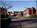
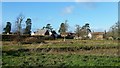
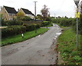
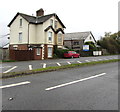
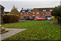
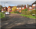
Living in GL2 7NR offers a quiet, residential experience in a small cluster of homes spread across 1270 square metres. With a population of 1798 and a density of 88 people per square kilometre, this area balances seclusion with proximity to essential services. The community is defined by its mature demographic, with residents predominantly aged 30–64 and a strong presence of homeowners. Daily life is shaped by nearby amenities such as Co-op stores and three railway stations, offering easy access to commuting routes. The area’s low flood risk and below-average crime rates contribute to a sense of stability. While it lacks large-scale infrastructure, GL2 7NR is ideal for those seeking a peaceful, family-oriented environment with minimal urban pressures. Its compact size means neighbours are likely to know one another, fostering a close-knit atmosphere. For buyers, the area’s limited footprint means properties are likely to be in established, well-maintained homes rather than new developments.
- Area Type
- Postcode
- Area Size
- 1270 m²
- Population
- 1798
- Population Density
- 88 people/km²
The property market in GL2 7NR is dominated by owner-occupied homes, with 78% of residents living in properties they own. This high rate of home ownership suggests a stable, long-term demographic, with few rental properties available. The accommodation type is exclusively houses, indicating that the area lacks flats or apartments, which may appeal to buyers seeking larger, standalone homes. Given the small size of the postcode area, the housing stock is likely limited to a handful of properties, making the market niche and potentially competitive for buyers. The absence of new developments means properties are likely to be older, with established gardens and private spaces. For those considering purchase, the area’s low crime risk and proximity to rail links add value, though the limited number of homes may require a flexible approach to location and property type.
House Prices in GL2 7NR
Showing 1 properties
| Address | Type | Beds | Baths | Last Sale Price | Last Sale Date | |
|---|---|---|---|---|---|---|
| Kidnams Farm, Hyde Lane, Whitminster, GL2 7NR | Detached | - | - | - | - |
Energy Efficiency in GL2 7NR
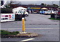
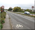
The lifestyle in GL2 7NR is shaped by its proximity to essential retail and transport hubs. Within practical reach are five retail outlets, including Co-op Eastington, Co-op High, and Tesco Hardwicke, ensuring everyday shopping needs are met without long journeys. The three nearby railway stations—Stonehouse, Cam & Dursley, and Stroud—offer seamless access to broader networks, whether for commuting, leisure, or visiting larger towns. While the area itself is small, the availability of these amenities suggests a balance between local convenience and regional connectivity. The absence of large-scale leisure facilities means residents may need to travel for entertainment, but the retail options and rail links provide a practical foundation for daily life. The character of the area is defined by its quiet, residential nature, with amenities tailored to a low-key, community-focused lifestyle.
Amenities
Schools
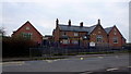
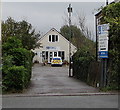
The nearest school to GL2 7NR is Whitminster Endowed Church of England Primary School, which serves the local community with a primary education offering. Rated ‘good’ by Ofsted, it provides a reliable option for families with young children. The presence of a single primary school suggests that secondary education may require commuting to nearby towns, but the school’s rating indicates a strong foundation for early learning. For families prioritising proximity to schools, this institution is a key asset of the area. The absence of secondary schools within the postcode means parents should consider transport links to larger educational hubs, though the nearby railway stations may ease this challenge. Overall, the school’s performance reflects the area’s commitment to education quality within its small footprint.
| Rank | School | Type | Entry gender | Ages |
|---|
Explore more schools in this area
Go to Schools tabDemographics
The population of GL2 7NR is predominantly adults aged 30–64, with a median age of 47. This suggests a mature, settled community, likely with a mix of long-term residents and families. Home ownership is high, at 78%, indicating a stable housing market with a focus on private residence rather than rental properties. The area is composed almost entirely of houses, reflecting a preference for standalone living over flats or apartments. The predominant ethnic group is White, which aligns with broader regional trends. The low population density of 88 people per square kilometre reinforces the area’s rural or semi-rural character, offering space and privacy. While no specific deprivation data is provided, the combination of high home ownership and low crime risk implies a relatively high quality of life, with residents likely prioritising security and long-term investment in their homes.
Household Size
Accommodation Type
Tenure
Ethnic Group
Religion
Household Composition
Age
Household Deprivation
NS-SEC
Explore more demographic insights in this area
Go to Demographics tabPlanning
Planning Constraints
- Flood RiskPremium
- Ramsar Wetland SitesPremium
- Area of Outstanding Natural BeautyPremium
- Protected Nature ReservePremium
- Protected WoodlandPremium