Area Overview for GL2 7LW
Photos of GL2 7LW
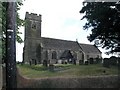
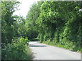
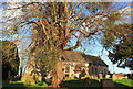
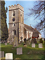
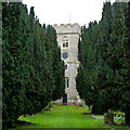
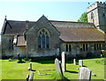
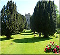
54 photos from this area
Area Information
Key information about the GL2 7LW including its size, population, and administrative classification.
- Area Type
- Postcode
- Area Size
- 27.7 hectares
- Population
- 2043
- Population Density
- 134 people/km²
House Prices in GL2 7LW
31
Properties
£309,063
Average Sold Price
£76,000
Lowest Price
£620,000
Highest Price
Showing 31 properties
| Address | Type | Beds | Baths | Last Sale Price | Last Sale Date | |
|---|---|---|---|---|---|---|
| 2, Oak Villas, High Street, Saul, GL2 7LW | Semi-detached | 3 | 2 | £380,500 | May 2025 | |
| The Coach House, High Street, Saul, GL2 7LW | Detached | 4 | 2 | £620,000 | Sep 2024 | |
| Roselea, High Street, Saul, GL2 7LW | Semi-detached | 3 | 2 | £450,000 | Sep 2023 | |
| Edelweiss, High Street, Saul, GL2 7LW | Detached | - | - | £422,500 | Mar 2020 | |
| Edelweiss, High Street, Saul, GL2 7LW | Detached | - | - | £422,500 | Mar 2020 | |
| Nirvana, High Street, Saul, GL2 7LW | Detached | 3 | 2 | £340,000 | Apr 2019 | |
| 3, Kites Nest, High Street, Saul, GL2 7LW | Semi-detached | 3 | 2 | £345,000 | Feb 2018 | |
| Orchard House, High Street, Saul, GL2 7LW | Detached | 4 | 3 | £530,000 | Apr 2017 | |
| Fairhaven, High Street, Saul, GL2 7LW | Bungalow | 2 | - | £150,000 | Aug 2013 | |
| 1, Oak Villas, High Street, Saul, GL2 7LW | Semi-detached | 4 | - | £278,000 | Jul 2012 |
Page 1 of 4
Energy Efficiency in GL2 7LW
Amenities
Schools
| Rank | School | Type | Entry gender | Ages |
|---|
Explore more schools in this area
Go to Schools tabDemographics
Household Size
Family (3-5 people)
most common
Accommodation Type
Houses
most common
Tenure
80
majority
Ethnic Group
White
most common
Religion
N/A
most common
Household Composition
N/A
most common
Age
47
median
Adults (30-64 years)
most common
Household Deprivation
N/A
with no deprivation
NS-SEC
39
in Lower managerial occupations
Explore more demographic insights in this area
Go to Demographics tabPlanning
Planning Constraints
- Flood RiskPremium
- Ramsar Wetland SitesPremium
- Area of Outstanding Natural BeautyPremium
- Protected Nature ReservePremium
- Protected WoodlandPremium