Area Overview for GL2 4YD
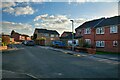
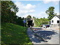
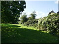
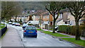
Photos of GL2 4YD


Area Information
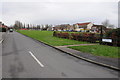
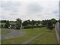
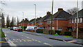
Living in GL2 4YD offers a quiet, residential lifestyle in a small cluster of homes. With a population of 1,927, this area is compact yet well-served by local amenities. The community is predominantly composed of adults aged 30–64, reflecting a mature demographic with strong ties to family living. Most properties are owner-occupied, with 74% of homes owned by residents, suggesting a stable and long-term presence. The area’s character is defined by its proximity to essential services, including a railway station and nearby retail outlets. Families benefit from access to The Crypt School, which operates as both a primary and academy with an outstanding Ofsted rating. Daily life here is practical and low-stress, with minimal environmental constraints and a low crime risk. While not a sprawling suburb, GL2 4YD provides a sense of security and convenience for those prioritising a balanced, community-focused lifestyle.
- Area Type
- Postcode
- Area Size
- Not available
- Population
- 1927
- Population Density
- 2695 people/km²
The property market in GL2 4YD is dominated by owner-occupied homes, with 74% of properties owned by residents. This high rate of home ownership points to a stable, long-term community rather than a transient rental market. The accommodation type is primarily houses, which are more common than flats or apartments. This suggests a focus on family-friendly housing, likely appealing to those seeking spacious, private living environments. Given the area’s small size, the housing stock is limited but consistent, with no indication of high-end or luxury properties. For buyers, this means a market that prioritises security and permanence over speculative investment. The absence of planning constraints such as protected woodlands or areas of outstanding natural beauty may also make it easier to renovate or extend properties. However, the small population and limited land area mean the market is unlikely to see rapid growth or significant price fluctuations.
House Prices in GL2 4YD
No properties found in this postcode.
Energy Efficiency in GL2 4YD
Residents of GL2 4YD have access to a range of local amenities, including five retail outlets such as Co-op Seymour, Morrisons Daily, and Lidl Linden. These shops provide convenience for everyday shopping, from groceries to household essentials. The Gloucester Railway Station offers direct rail links to surrounding areas, enhancing mobility for commuters and visitors. While the data lists three instances of Gloucestershire Airport, this likely reflects proximity to a single regional airport, offering travel options for those needing to fly. The mix of retail, transport, and travel infrastructure supports a practical lifestyle, with minimal need to travel far for basic needs. The area’s compact size ensures that amenities are within easy reach, contributing to a low-effort, community-focused way of life.
Amenities
Schools
Residents of GL2 4YD have access to The Crypt School, which serves as both a primary school and an academy. The latter is rated outstanding by Ofsted, indicating high-quality education and strong performance. This dual role means families can access primary education for younger children and continue with secondary schooling under the same institution’s framework. The presence of an outstanding-rated academy is a significant draw for families prioritising academic standards. While the data does not specify the school’s exact location relative to the postcode, its inclusion in the area’s amenities suggests it is within practical reach. The combination of primary and secondary provision under one name reduces the need for commuting to other areas, enhancing the convenience for local families.
| Rank | School | Type | Entry gender | Ages |
|---|
Explore more schools in this area
Go to Schools tabDemographics
The residents of GL2 4YD are predominantly adults aged 30–64, with a median age of 47. This suggests a community with a strong presence of middle-aged individuals, many of whom are likely to be in their prime working years. Home ownership is high at 74%, indicating a stable housing market with a focus on long-term residency. The area is characterised by houses rather than flats, aligning with a preference for family homes. The predominant ethnic group is White, reflecting a homogenous demographic profile. While no specific data on deprivation is provided, the high home ownership and low crime risk suggest a generally affluent and secure environment. The absence of detailed diversity metrics means the community’s broader social composition remains less defined, but the available figures highlight a settled, middle-aged population with strong ties to property ownership.
Household Size
Accommodation Type
Tenure
Ethnic Group
Religion
Household Composition
Age
Household Deprivation
NS-SEC
Explore more demographic insights in this area
Go to Demographics tabPlanning
Planning Constraints
- Flood RiskPremium
- Ramsar Wetland SitesPremium
- Area of Outstanding Natural BeautyPremium
- Protected Nature ReservePremium
- Protected WoodlandPremium